All posts by xyHt

xyHt Weekly News Recap: 04/7/2023
More Than 135 Exhibitors Set for September Commercial UAV Expo SAM Companies Acquires Carolina Surveying Services Inc. Globhe Expands to Inspect Wind Rotor Blades Globally NGS Day at FIG Working Week 2023 Pete Buttigieg Still Believes in Smart Cities Land Surveyors are Aging and Retiring in Michigan Amid Ongoing Needs Next Generation Street-Level 3D...
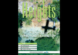
xyHt Magazine Heights 2023
Click on the cover to view the Heights 2023 supplement to xyHt magazine. Articles in the issue include: From Nadir to Oblique: From traditional airplanes to new-fangled gyroplanes, we take a look at several aspects of the aerial geospatial technologies that just keep getting better. The Future of Photogrammetry: While UAVs continue to emerge as aerial mapping vehicles, there...
xyHt Weekly News Recap: 03/31/2023
The First 30cm High-Definition Global Imagery Basemap Woolpert Opens Paris Office, Expands Support for European Customers CNH Industrial to Acquire Hemisphere GNSS Automation Asset Inspection Company Thread Expands into Canada Esri Book Demonstrates How to Create Map Apps with User Experience in Mind The Integration of BIM Data and City Models Using Geo-BIM VOTIX and Iris Automation...

Sustainable Rainwater Treatment for the Future
How machine-control solutions are increasing efficiencies on ground-breaking projects by up to 60 percent The seaside town of Køge lies just forty minutes south of Copenhagen in Denmark. A rapidly expanding area, new housing projects and transport infrastructure are an immediate priority for residents and local authorities.But, for a town located just three meters above...
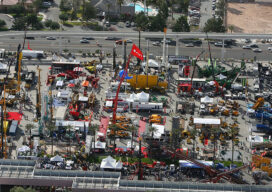
The Future of Construction on Display at CONEXPO-CON/AGG
Five jam-packed days of innovative product launches, enlightening education sessions, and countless networking opportunities at CONEXPO-CON/AGG & IFPE 2023 have taken the construction industry to the next level. The show crushed expected attendance numbers, drawing over 139,000construction and fluid power professionals from 133 countries to Las Vegas from March 14 to 18, making it the...
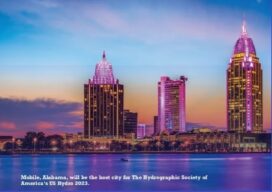
Hydrospatial: The Next Frontier of Hydrography
Staying Fluid The theme for US Hydro 2023 reflects the relevance that our profession and related sciences have in the marine geospatial world. In some circles we are discussing the profile of “the hydrographer of the future” (the Canadian Hydrographic Service is leading a series of workshops on this topic), what they have to learn...