All posts by xyHt

xyHt Weekly News Recap: 10/28/22
INTERGEO Celebrates a Successful Comeback Fathom launches new Global Flood Map Innoviz and Kudan Team Up for Lidar-Based Geospatial Mapping Solution Across Industries Cartegraph and Center for Digital Government Share Results of Infrastructure Funding and Technology Survey Leica AP20 AutoPole wins Wichmann Innovations Award at INTERGEO 2022 New Lidar Solution Delivers Survey-Grade Data from UAV...
xyHt Weekly News Recap: 10/21/2022
Teledyne Announces Ladybug6 Cameras for High Accuracy 360-Degree Spherical Image Capture Hexagon and LocLab Work to Accelerate Adoption of Smart Digital Realities Vexcel Imaging Introduces UltraCam Eagle 4.1 Photogrammetric Aerial Camera System Phase One to Launch New Calibration Center at Denver Headquarters Soaring Eagle Technologies Receives Long Distance FAA Waiver for UAS Inspections Common Ground Alliance...
xyHt Weekly News Recap: 10/14/2022
New NSRS Modernization Release Timeline: Mid-2025 Geo Week Calls for Nominations for Excellence in the Geospatial Industry Trimble Changes Headquarters to Westminster, Colorado Mapping Site ShowMyMap.com Rebrands to Mapize.com DOE Announces First Cohort of Post-Secondary Programs to Receive New Zero Energy Design Designation Ashley Hitt to Serve as President of URISA SmartGeo Expo 2022 to...
xyHt Weekly News Recap: 10/7/2022
NSPS to Participate at WATERS Summit Iowa Couple Locked in Legal Battle to Halt Survey of Farm for Pipeline U.S. Army Corps of Engineers Surveys Beaches Following Ian Popularity of Drones for Mapping Creates Lucrative Opportunities for Surveying & Mapping Providers Intergeo Starts in Less Than Two Weeks Trimble Dimensions+ Less Than One Month Away ...
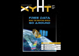
xyHt Digital Magazine: October Issue
xyHt’s October issue focuses on data acquisition, whether from GNSS, your smartphone or the increasingly available satellite data that is being made on the Internet for free. As always, if you don’t have a subscription to our print edition, or if someone else in the office has snaffled your copy, don’t fret, here is the...
xyHt Weekly News Recap: 09/30/2022
Teledyne and Seabed 2030 to Study Impacts of Volcanic Eruption in Tonga Greater St. Louis, Inc. Wins Esri Special Achievement in GIS Award Bluesky Takes to the Skies to Capture More Oblique Views of UK Cities Bentley, Genesys to Provide 3D Mapping Capabilities for Cities across India Free Webinar: What’s the Latest in Survey and...