
All posts by xyHt

xyHt Magazine January 2019 Issue
Click on the cover below to view the January 2019 issue of xyHt magazine. Articles in the issue include (links will turn live throughout January): GPR on a Drone – An international research team used new UAV and GPR technology to locate a lost U.S. airplane 300 feet below the ice in Greenland. PS Exam Changes –...

Weekly xyHt News Links: 12/21/2018
CHC Navigation releases all-in-one GNSS RTK solution Gexcel presents the new HERON® Indoor Mobile Mapping System Sky Power presents newly developed SP-110 FI TS Combining a large format camera with hi-performance LiDAR, achieving 3cm orthophoto and 12ppm point cloud simultaneously
Weekly xyHt News Links: 12/14/2018
ESA’s Pioneer mission sends GNSS-RO nanosatellites into orbit GPS to get terrestrial backup system Future of Defense is Here: Security Pro USA Introduces its new Smart Aerial Security Drones Blue Marble Releases Geographic Calculator 2019 with Updated Geodetic Datasource and Numerous Workflow Improvements Microdrones Merges with Schübeler Technologies
Weekly xyHt News Links: 12/7/2018
A look at NGS’ experimental and hybrid geoid models How much can you earn in the Geospatial Industry? Russia plans to place positioning satellites around the Moon Tersus introduces Oscar GNSS RTK system Septentrio launches tiny Mosaic high-precision GNSS module Enview Launches AI-powered Solution to Automatically Detect Vegetation Near Power Lines Carlson Software Releases Carlson...
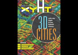
xyHt Magazine December 2018 Issue
Click on the cover below to view the December 2018 issue of xyHt magazine. Articles in the issue include (links will turn live throughout December): 3D Cities from a Single System – a look at a unique hybrid airborne system that combines lidar with oblique and nadir imagery. Who Does SUE? – Subsurface utility engineering isn’t really engineering;...
Weekly xyHt News Links: 11/30/2018
Topcon Introduces ‘Infrastructure and Technology’ Documentary Series Septentrio boosts its portfolio with mosaic GNSS module Federal Geographic Data as a Strategic Resource Topcon introduces ‘Infrastructure and Technology’ documentary series LiDARUSA Announces Z+F Mobile Systems Leica Geosystems offers new Utility Surveyor Course GeoSLAM Adds Indoor and Outdoor Handheld Scanner to Product Range Bentley Acquires Machine...