
All posts by xyHt
Paula Gentle
Geodetic Surveyor, LINZ New Zealand Land Information New Zealand (LINZ) is the primary national government geospatial agency managing maps, charts, land records, and the national geodetic reference system. Paula Gentle is one of the geodetic “shepherds” of the reference infrastructure of physical survey marks and trig beacons. New Zealand is quite tectonically active, and part...
Rhea Lyn Dealca
Director of Projects and Administration, Foundation for Economic Freedom Philippines After working with the UN-Habitat/Global Land Tool Network in Nairobi, Kenya in 2015, Rhea Lyn Dealca returned to the Philippines where she believes she can make the greatest impact. As a geodetic engineer, she has spent more than 10 years working for the government, including...
Belinda Serafin
Graduate Surveyor, Sydney Trains Australia Sydney Trains is the premier public transportation system for this city of more than four million. With infrastructure serving more than 340 million rider trips per year, the maintenance, upgrade, expansion, monitoring, and mapping for properties, planning, and environmental matters require a top surveying team. In 2017, a new graduate...
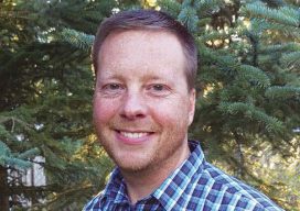
Aaron M. Butterer
Land Services Specialist, Alaska Railroad Alaska, USA A powerful skillset of expertise in surveying and GIS plus business acumen is what Aaron M. Butterer is known for. At The Alaska Railroad Corporation (ARRC), Aaron is instrumental in preparing all forms of survey drawings, legal descriptions, and exhibits in support of leasing activities of the real...

Weekly xyHt News Links: 1/19/18
TeraBee Releases a New Low-cost & Long-range Sensor Matterport 3D Spaces now Google Street View Compatible, Firmware Update Improves Camera Speed The 2018 Commercial UAV Expo, Incorporating Drone World Expo, to Be Held in October in Las Vegas

Mark Edwin A. Tupas
Instructor in the Department of Geodetic Engineering, the University of the Philippines, Philippines Noted for his dedication to improving the accessibility and utility of geographic information in the Philippines, Mark Edwin A. Tupas was nominated because he’s an inspiration to other geospatial professionals in the region. Mark teaches remote sensing, spatial databases, and object-oriented programming. He...