
Blog

Exit Interview
Questions and answers with retiring NSPS Executive Director Curtis Sumner Curtis Sumner has had a venerable career in surveying, starting as an 18-year-old straight out of high school and finishing as the long-time executive director of the National Society of Professional Surveyors (NSPS). Raised in the beautiful Blue Ridge Mountains of southwestern Virginia, Sumner gained...

xyHt Magazine Digital Edition: November 2021
Like a good surveyor, xyHt‘s November issue covers a lot of ground, bringing you stories about BIM, UAVs, lidar and an in-depth interview with retiring NSPS executive director Curt Sumner. As always, if you don’t have a subscription to our print edition, or if someone else in the office has snaffled your copy, don’t fret,...

xyHt Weekly News Recap: 10/29/2021
Trimble, Microsoft Partner to Drive Digital Transformation Across Industries H3 Dynamics Launches World’s Most Advanced Drone Charging Station DarkPulse Multi-Rotor Drone Achieves 60-Minute Flight Times Rand McNally Rolls Out Massive Upgrade to its Navigation Devices Bad Elf Introduces Laser Offset Workflow for Esri ArcGIS Field Maps UCF Researchers to Develop Non-GPS Location Finder RIEGL Introduces...

Protecting Urban History
Researchers demonstrate how lidar, combined with imagery and hyperspectral data, helps prevent costly damage to historic buildings in urban construction zones. With every new underground urban rail or roadway tunnel, deep foundation shaft for a new building, or even simple streetscape upgrade, historically significant architecture in older city centers can become vulnerable. Earth displacement from...
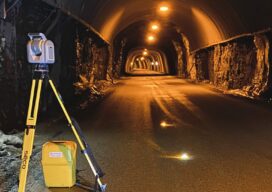
Tunnelling to a New Approach
A surveyor switches from conventional technology to the Trimble SX12, enabling her to match the frenetic pace at six times the speed of multiple-person crews.
xyHt Weekly News Recap: 10/15/2021
URISA Leaders Recognized at GIS-Pro 2021 Aero-Graphics Hires Daryl Southard as Director of Business Development Dewberry Acquires the Latest RIEGL VQ-1560 II-S Airborne LiDAR System Seamless, Automatic Thermal Imagery Based Inspection Available now for Remote Digital Inspections AI Surveyor is First Intelligence Platform for Large Infrastructure Projects Septentrio, ArduSimple Bringing Reliable GPS/GNSS to Emerging Applications North...
Advertisement