
Researchers demonstrate how lidar, combined with imagery and hyperspectral data, helps prevent costly damage to historic buildings in urban construction zones.
With every new underground urban rail or roadway tunnel, deep foundation shaft for a new building, or even simple streetscape upgrade, historically significant architecture in older city centers can become vulnerable. Earth displacement from settlement and the vibration from urban construction can cause costly and sometimes irreparable damage to structures and their aesthetic treatments.
It’s staggering to think that construction-related damage often amounts to between five percent to 10 percent of gross project costs, as designers and contractors face litigation and are often required to cover the cost of repairs of priceless old buildings.

The O’Connell Bridge and River Liffey in Dublin City Centre was built between 1791 and 1794. Historic assets like these and the surrounding buildings could be damaged during construction of the proposed Dublin MetroLink, transit project that would include a tunnel under the historic city center.
The potentially high cost of damage to historic buildings can take all the profit from a project or make the risk too high to move forward. A major urban transit project that might cost upwards of a billion dollars could result in hundreds of millions of dollars in damages and reparations. When engineers can predict the vulnerabilities and make plans to mitigate damage, the risk goes way down and can be factored into the overall cost of the project.
Consider also the public and media outcries when old treasures are deemed structurally unstable and then must be demolished.
In our excitement and enthusiasm to create modern assets we often don’t want to admit that at the project end, if there is a lot of damage to treasured old structures, well…there goes all your profit and your company’s good name as well.
Researchers from New York University (NYU) and University College in Dublin (UCD) have performed two major lidar-data collection projects that pioneered new workflows to reduce such damage. Their strategy is to create a high quality co-registered 3D and hyperspectral data resource early in the project that could be provided to design and construction teams before shovels start turning ground. Using this data as a key component of the traditional engineering workflow for modeling and analysis, the team can better identify where potential vulnerabilities might lie. Then they can properly plan ahead to avoid costly damage.
Sometimes a simple route adjustment could save hundreds of millions of dollars in damages. Or perhaps a different construction technique in certain areas, like using drilled shafts or auger cast rather than pile driving will reduce vibrations. Or maybe using fewer, deeper shafts would be less risky than installing a great quantity of shallow foundations.
If precise, information-rich data were available about potentially fragile buildings early in the project, the geotechnical engineer, structural engineer, and contractor could put their heads together and devise the best, sometimes less obvious choices that can make an enormous difference in the grand scheme of things.
Removing the Question Mark
NYU professor Dr. Debra Laefer probably knows better than anyone in the world exactly how subsurface construction in one area can affect nearby historic buildings. With advanced degrees in geotechnical and structural engineering, as well as 30-plus years of study, observation, and research experience, she has become an international authority on the subject.
This article presents two research projects Laefer led that show the benefits of having high-density aerial lidar as a key data source for urban construction in historic neighborhoods, taking the heavy construction industry a step forward in protecting the past. The story includes information on how others can accomplish the same results, and a brief interview with Laefer about the biggest takeaways of the research.
Dublin, Ireland: Locating vulnerable historic assets with lidar
While serving as professor of the School of Civil Engineering at UCD, Laefer was awarded several research grants in advance of the planned €3 billion Dublin MetroLink rail project. The city was then, and still is, weighing the pros and cons of creating a below-grade rail line that runs from the Dublin airport southward and underground, burrowing beneath the historic city center, and ultimately continuing further south beneath more historic commercial and residential neighborhoods.
The mobility benefits of the rail project are obvious. Dublin is Ireland’s primary business and tourism hub with heavily congested streets that do not meet existing or projected transportation needs. On the other side of the coin, the project would incur enormous costs and create quite a bit of disruption for many years. But a greater, more intangible cost needed to be considered.
The value of the historic buildings and landmarks for tourism and quality of life for residents cannot be quantified. A massive linear project of this nature, with the necessary heavy machinery vibration and earth displacement, would likely damage many important structures in communities along the route. City leaders needed to know if the project would ultimately be worth the price.
Laefer’s team was awarded several grants associated with the project. Among them was a grant from the European Union (EU) titled: “RETURN: Rethink-ing Tunnels in Urban Neighborhoods.” The objective of the grant was to create a workflow in which high-density aerial lidar could be collected to sufficiently capture the building facades of Dublin’s historic city center. This amazing data set could then be used to locate potentially vulnerable buildings along the route of the tunnel being considered.
Laefer’s team at UCD successfully conducted the research, and there were many papers and presentations that resulted. The rail project is in the final go-no go stage and may move forward in 2021.
This Dublin-based research project received international attention, and paved the way for a similar, next-gene-ration research project in the United States that pushed the envelope of co-registered, multi-sensor data.
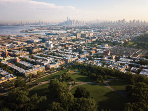
Sunset Park in Brooklyn, with downtown Manhattan in the background, is a historic neighborhood on New York’s Upper Bay where high-density lidar is being used as a direct input into flooding models and for better risk communication.
Sunset Park in Brooklyn: Can integrating hyperspectral data with lidar protect historic architecture?
Laefer left the UCD in late 2016 when she accepted a role as professor of urban informatics for the Center for Urban Science and Department of Civil and Urban Engineering, Tandon Engineering at NYU. Her new research team at NYU will soon release a next-generation high-density urban lidar dataset conducted in a one-square kilometer area of Sunset Park, a mixed-use neighborhood in Brooklyn, home to many historic row houses and other landmark buildings. Interestingly, this area is known to many as a portion of the route of the New York Marathon. A 2016 article in the New York Times called Sunset Park “one of New York’s next hot neighborhoods.” Infrastructure modernization and growing industry and residential growth could put older, character-rich buildings at risk.
The New York City Landmarks Preservation Commission (LPC) is hoping to protect and preserve historically significant buildings and sites throughout New York, including Sunset Park. In 2019, the commission designated four historic districts in Sunset Park that exemplify the historical and architectural history of the neighborhoods that were constructed in the late 19th and early 20th centuries.
Laefer received several grants that supported the research work in Sunset Park, most notably among them a jointly funded grant from the U.S.-Ireland Partnership Program called UrbanARK: Assessment, Risk Management, and Knowledge for Coastal Flood Risk Management in Urban Areas. This $1.2 million grant was jointly funded by the U.S. National Science Foundation (NSF), Science Foundation Ireland (SFI), and Northern Ireland Trust (NI) and was awarded in 2018 to investigate how high-density lidar can be used as a direct input into flooding models and for better risk communication.
The objective for this grant builds on the research that Laefer’s team completed in 2015 for the Dublin Metro Rail project.
In the five years since the Dublin project was conducted there have been advancements in laser-scanning technology, especially with the introduction of RIEGL’s VQ-780i airborne lidar scanner. Laefer was able to apply some lessons learned from the Dublin project to Sunset Park. With the advanced sensors, the quality of the data was better than previously possible. This was accomplished by fine tuning the flight pattern to further maximize vertical surface capture and to reduce occlusions.
During the aerial data collection for Sunset Park, a Brooklyn neighborhood along New York’s Upper Bay, Laefer’s research team conducted about 300 experiments to test the limits of object and material detection from 1,000 feet. Many of these involved automating material identification by co-registering a concurrently captured hyperspectral data set. Next will be trying to reliably extract the hyperspectral signatures of each material and training a machine-learning model to find similar materials in the built environment.
By knowing what materials were in play on these old surfaces, engineers can calculate structural stiffness and pinpoint vulnerabilities of buildings. Materials (such as concrete, marble, glass, brass, asphalt, steel, and gravel) of the buildings in the construction grid can be mapped, viewed, and accessed for risk. The data will also be used to automatically identify spaces such as basement apartments that may be especially prone to flooding.
The data set is the beginning. From there it can be integrated with a subsurface hydrological model to quickly identify potential areas of vulnerability. Details can be viewed and considered largely from the comfort of a designer’s office. Measurements can be made in seconds with a few clicks of the mouse. Infrastructure assets can be mapped. Supplemental information such as interior structural plans can be co-registered, if they are available.
Three-dimensional technology continues to get better, faster, and cheaper. Providing teams with 3D engineering-grade surveys that are geo-referenced, easier to use, and less expensive to obtain are well within reach.
How to Start
Laefer’s PhD research teams are typically made up of civil engineering and computer science students who are led based on her own engineering background and expertise in using lidar and hyperspectral sensors. In both Dublin and Sunset Park, her teams sought out private airborne survey firms to work with, and together carefully planned the lidar flight missions to maximize the vertical data capture.
In the case of Sunset Park, the team collaborated with Tuck Mapping Solutions, a survey firm based in Big Stone Gap, Virginia. Bobby Tuck, the company president, worked closely on preplanning with the research team to determine the best way to obtain the different types of data from his helicopter-mounted sensors.
Tuck has been an innovator in collecting airborne lidar and imagery for many years. Knowing the information they needed, Tuck designed a pod and platform for his helicopter that could carry and operate the specific sensors required. Every detail was discussed with the researchers, and they worked together on a flight plan that would optimize the results—collecting highly precise data with very little “noise” safely and efficiently.
Tuck’s team worked closely with Laefer to optimize a flight plan and grid that would capture the sides of the buildings and structures. By flying at a 45 degree angle and back, it gave them better data and much more of it.
“The plan was to first fly parallel to the city streets in this one-square-kilometer area of the Sunset Park neighborhood,” Tuck said. “And then we repeated the parallel collections perpendicularly. Once the parallel scans were done, we went back and flew it at a 45-degree angle, and as before, we collected data in the reverse direction as well. Our flight lines were close together, and we went over the route seven or eight times so that we were sure to get the point density (Laefer’s) research team needed.”
There were many challenges to overcome. Because the area is near several
major airports, it is in a no-fly zone. “Our relationships with air traffic controllers helped us obtain the permissions necessary for the flights,” said Tuck. “We had a very narrow window to conduct the flights due to FAA permissions. Add to that the altitude restrictions, and weather was also a factor.”
The team also needed to coordinate closely with the local fire department. “To say it was challenging is an understatement,” he laughed. “Once we were able to secure permission, there were many flight restrictions especially after 9/11. We needed to stay below 1,000 feet so we planned the flight path at 800 feet.”
Tuck’s plan was to make sure they thought of everything and then get in and out safely and quickly. The choice of a helicopter would allow them to make tight turns and they traveled as slowly as was safe (about 50 mph) at a consistent altitude. “For normal projects we would fly using only one pilot, but for this project we wanted to exercise extreme safety measures, so we flew with two pilots.” The entire collection was performed in about four hours of flight time.
“Debra (Laefer) was wonderful to work with. First of all, she’s brilliant, and because of her previous experience in Dublin she found ways to improve every part of her project, including the way the data would be collected.
“When we got the ‘go,’ two of my pilots flew to an airport near Sunset Park from our location in Virginia and spent the night so we could start the job from there the next day. Timing was very important because we needed to coordinate with the research team. While we were in route, (Laefer’s) team had laid out various types of materials in a parking lot: gravel, grass, asphalt, concrete, etc., and we captured it with the rest of the data. Every surface has its own DNA, I like to call it. Our hyperspectral sensors could record the samples they laid out, and then they can be used to match up with the images in the rest of the data set.” This step exponentially increased the value of the datasets.