
Blog
Don’t Buy a Drone
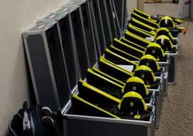
Instead, invest in a fleet of drones. (Apologies for the clickbait headline!) While I was talking to a surveyor whose firm employs UAS in their work, he mentioned the different models of the craft they have. I interrupted him: “Just how many drones do you have?” “16” was the answer. This got me thinking about...
Geomatics at Nicholls State University
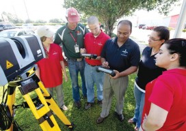
A profile of their geomatics program Above: Students receive instructions on laser scanning. L-r: Jessica Freeman, Kent Hebert, Paul LeBlanc, Dr. Balaji Ramachandran, Monica Crout, and Ann Hebert. Nicholls State University in Thibodaux, Louisiana, initiated its new four-year Bachelor of Science degree program in geomatics during the summer semester of 2003. This program is a...

xyHt Weekly News Links: 8/4/17
Dewberry Honored for Special Achievement in GIS Reps. Westerman and Moulton Introduce Bipartisan Geospatial Data Act | Congressman Bruce Westerman GeoCue Announces GNSS Direct Geopositioning System for Low Cost DJI Drones Nearmap Provides High-Rez Oblique Imagery and 3D Products in Ready-to-Use Service ILMF Call for Papers Deadline is August 14! Congressman Doug Lamborn Addresses MAPPS...
Are HARNs on Death Row?
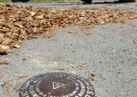
In the late 1980s, the National Geodetic Survey (NGS) launched a program, in cooperation with State partners, to establish a High Accuracy Reference Network (HARN) across the United States. HARN’s History With the rapidly increasing availability and use of GPS equipment, NGS recognized the need to establish a network of high-accuracy, passive survey monuments with...

xyHt at Intergeo
Hello! You must’ve met us at Intergeo in Berlin, and you may want more information about us. If so, click our logo above to get to our homepage, and then feel free to investigate our site. You can subscribe to our magazine by clicking on the subscribe button above, as well.
xyHt Magazine August 2017 Issue
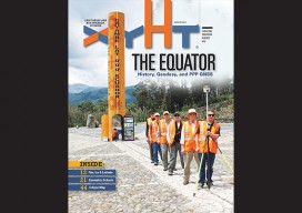
To view this issue as it appears in full in print, click the cover: Below are featured articles from the issue on our website: Editorial Fire, Ice, and Latitude in Ecuador Nicholls State University Geomatics Program Photogrammetric Engineering at The National Polytechnic Institute Drones and Surveying Flood Zones Controlling the Future with Training Women in...
Advertisement