
Blog

xyHt Weekly News Links: 8/25/17
Introducing SXblue Ultimate Survey Grade GNSS Receiver Joint NASA-Brazil CubeSat mission will unlock equatorial phenomena that affect GPS Geodetics Inc. Announces Point&Pixel Solution Allowing Photogrammetry While Reducing the Need for Ground Control Points Win a Free Schonstedt!

Certifications or Licensing? Part 3
Part 3 of 6: Legal Issues Affecting State Licensing Editor’s note: What will regulation, certification, and licensing of the surveying profession look like in the near and distant future? Surveying is and always has been molded by external influences: markets, technologies, economic conditions, demographics, and competition from outside of the profession. Other professionals, consumers, and...
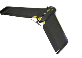
UAVs Planting Trees
… And What That Means for Next-gen Drones Honestly, I don’t pay much attention to unusual uses of UAVs; I focus on geospatial applications. However, after reading the news about a company using UAVs to plant trees, perhaps I should. Let’s take a look at the story and see what it could mean for the...

The Land Office: Potawatomi and Surveyor History
The Art of Retracement Pictured above: The rover stands on the original monument, which predates two newer monuments, next to each other 12 feet away, by 100 years. Credit: Warren Ward. Igor Kidinski, or Eager (the Kid) as he was known, started to shout “Got it!” when he saw a point on the ground. But then...
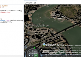
Add 3D Tiles to Cesium 1.36 to Make 3D Virtual Scenes
As blogs come, this has to be (for me) one of the longest. You see, I’ve been playing with Cesiumjs since its beginning and following the exciting beginnings of the “3D Tile” for the last 3 years. I’ve waited patiently, waiting for the moment I could share with the world how fantastic this new technology...
xyHt Weekly News Links: 8/18/17
PufferSphere Makes the World Go Round with Spherical Displays Joint venture to bring high-precision positioning to mass market Nearmap delivers new 3-D content and oblique imagery Hexagon Imagery Program announces updates to 2017 airborne imagery collection plans INTERGEO: where the future is within your grasp!
Advertisement