Category Archives: GNSS/Location Tech
Sid Nair
Sid Nair – Senior Director, Marketing and Product Management, Teletrac-Navman – California, USA There’s a lot of talk about “the internet of things,” or IoT, but of great and lasting value is “the internet of where things are”—how better to manage assets and processes spatially. There are all sorts of ideas of how to make...
Shannon Hixon
Shannon Paul Hixon – Product Manager (High End) NAFTA, Leica Geosystems Inc. – Colorado, USA If you are a customer of Leica surveying products, you probably know the name Shannon Hixon well; he has often been the go-to guy for advanced end-user inquiries, but more recently Shannon has moved into product management. Shannon graduated from...
Sarang D. Thombre
Sarang D. Thombre – Dr. Sc. (Tech), Senior Research Scientist, Deputy Leader of Research Group – Intelligent Mobility and Geospatial Computing, National Land Survey of Finland, Finnish Geospatial Research Institute, Department of Navigation and Positioning – Finland Sarang leads the technology implementation for the project Enhanced Situational Awareness to Improve Maritime Safety in the Baltic,...
Lindsay Renkel
Lindsay Renkel – Geospatial Marketing Specialist, Trimble – Colorado USA In the not-so-recent past, segments of geospatial industries were viewed more as rigid verticals, and cross-discipline and integrated workflows were realized through innovation in applied tech. That’s when companies like Trimble began to organize under new functional divisions. Marketing a broader range of products and services could...
Jason Paris
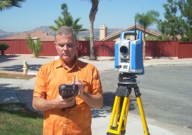
Jason Paris – Sales Engineer, Leica Geosystems – California USA One of the challenges of developing highly sophisticated equipment and solutions is successfully conveying the benefits to potential users and clients. Jason Paris was nominated by some of his customers and colleagues in Leica Geosystems as someone who has a particular grasp of the practical...

RTCM
Real-time correction messages: Why this is important and where it’s going Most professional users of GNSS equipment are familiar with the term RTCM. You likely understand that RTCM is a language that is used for delivering real-time corrections to rovers. But that’s usually where the understanding of RTCM stops. This article outlines what RTCM is,...
