Category Archives: Lidar/Imaging
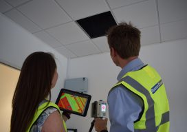
Refitting a Building in Continuous Operation
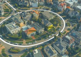
I’m a surveyor and technical specialist at Plowman Craven, one of the largest surveying companies in the UK. My company has worked closely with Leica Geosystems for more than 50 years, going back to the days of the T2 mechanical theodolite and DI10 EDM. Technology is different now, but the collaboration between our two organizations...
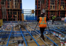
A Truly Unique Scanner
A look at innovation in hardware, software, and workflow in the Leica RTC360. Not far from London in the UK is a place called Milton Keynes. Although it’s not as famous as places like Manchester, Birmingham, or Brighton, it is the home of the Red Bull Formula 1 team; it’s where WD40 is made; and...

Virtual Reality Training Thanks to Scanning
Laser scanning helps create effective VR training for public safety in England. While virtual reality (VR) is commonly associated with video games, it is shaping many industries by opening up a vast array of new possibilities to sell products, experience places, or train employees. VR has multiple applications based on its ability to immerse users...
Life after the Little BLK360 Scanner’s Big Splash
Above: A “new-user” 1-person firm scanned this complex historic building in five hours with 75 set-ups of the BLK360 and created final drawings. Credit: Southwest Scanning. Almost everyone is familiar with splashy announcements of new products. For much of my career with Trimble and with Leica Geosystems, I personally drove many product introductions, so I’m tuned into...
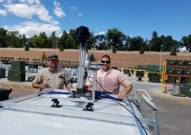
The Evolution of Using Lidar
Above: Gary Rust (left) and Anthony Whitlock from Springs Utilities pose with their LiDAR USA HiWay Mapper HD. The history of a Colorado utility systematically deploying lidar technology reveals lidar’s journey as an asset. Located at the base of Pikes Peak on the front range of the Colorado Rockies, Colorado Springs Utilities is a city-owned...
Embrace the Mesh
Above: A full 3D textured model of San Francisco produced through Skyline’s PhotoMesh 3D Reconstruction software and streamed for visualization and analytics in Skyline’s TerraExplorer. Surveyors and photogrammetrists capture reality data. But to model, manage, and provide access to massive and complex datasets—to provide your clients with true 3D mesh reality capture—you’re going to need...