Category Archives: Lidar/Imaging

The Future of Autonomous Transport
Geospatial technologies play a pivotal role for the Transport Systems Catapult, the UK’s not-for-profit innovation center for intelligent mobility. The town of Milton Keynes is at the heart of the UK’s transport revolution. It’s home to several tech start-ups and major transport-related brands, such as Network Rail (the UK’s rail authority), Leica Geosystems, Mercedes, VW,...
A Student SLAMs Stuttgart
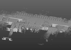
As part of a bachelor’s thesis project, a university student successfully scanned more than 21,000 sq ft of complex office space in just 40 minutes with a mobile 3D laser scanner (the GeoSLAM ZEB-REVO), despite having never previously used the device. The point cloud created from the first-time scanning work was sufficient to generate an...

Slam an Entire Building
A Danish surveyor measured the floor area of 13-story building in 1.5 hours with a mobile 3D scanner. Accurately calculating the floor space area in a new building (either residential or office) has serious legal implications in Denmark, and this service has become important business for surveying companies there. One of these firms, LIFA Surveyors,...
Laser Scanning for GIS and FM
On the surface, rich laser- scan data seems like a natural, valuable addition to GIS and facility management (FM) solutions—and to related operations and maintenance and asset-management capabilities. Much as the emergence of GPS in the 1990s helped drive GIS adoption and growth, the emergence of laser scanning also feels ready to aid GIS, FM,...
Low-cost Tech for Aerial Archeology, Part Two
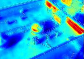
To round up this short series on low-cost approaches to aerial archeology surveying, we’ll look at an even lower-cost sensor technology that can be used in certain types of archeological projects. In the first part of this series we talked about how new, affordable multispectral sensors are being used with (relatively) inexpensive UAS to find...
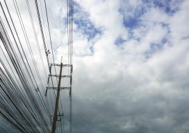
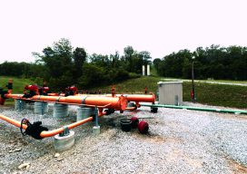
Powerline Inspection
Drone? Ground? Helicopter? For years now drones, UAVs, UASs or whatever you wish to call them have been the revolution that promises to change the way we live. Five+ years into the drone revolution we are seeing some change—but it has certainly been a slower progression than expected. Linewise Aerial specializes in transmission line inspection...