Category Archives: Lidar/Imaging
Lidar and The Lost City of the Monkey God
The timing was uncanny; I had just finished Douglas Preston’s The Lost City of the Monkey God when news of another major, new, lidar-enabled archeological find in Central America broke—at the same time I was attending the International Lidar Mapping Forum (ILMF) in Denver, Colorado. Then, while I was attending Teledyne Optech’s product presentation at...
What I Saw at ILMF 2018
ILMF is an outstanding conference for all things lidar, including airborne, terrestrial, and underwater, as well as new remote-sensing and data-collection tools and technologies. I try to attend every year because it never gets old; there are plenty of new and exciting technologies, both on the exhibit floor and in the many workshops and presentations....
UAVs and Laser Screening: Friends of Foes
Some professionals predicted doom for terrestrial scanning right when inexpensive drones with calibrated cameras hit the market and new image processing software wowed audiences with cool 3D mesh models of statues. But how have things actually turned out? I recently interviewed key industry users and vendors who are deep into both technologies – here’s what...
Michelle Japitana
Instructor and Concurrent Chairman, Engineering Sciences Department, Carga State University, Philippines Testimonials for Michelle Japitana were remarkable. (This year we received a record number of nominations from the Philippines, and we wish we could honor all the fine candidates.) Michelle’s nominators noted that her strength in the geospatial community is her research capabilities in the fields...
Nicolette Beggache
Technical Support Engineer, Leica Geosystems United Kingdom Geospatial magic springs from experience, education, and training, but also from tools— hardware and software. While the processes and workflows are being streamlined and developed for ease of use, this also means that when users encounter conundrums in seeking to drive their tools to greater heights or in...

No Job Is Too Big or Too Small
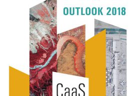
Alexandra Grounds, Founder & Director, Grounds Associates, Ltd. Editor’s note: In this year’s Outlook issue, we present trends in geospatial technologies and vision statements from key geospatial industry firms, but we also highlight smaller operations: the agile, tech-savvy, and talented practitioners and their teams. As the need for geospatial data and expertise grows, career paths...