Category Archives: Lidar/Imaging
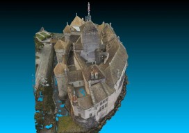
Chillon Castle: A Pix4D Sample Project
Above picture: Point cloud of full model of castle, shown from the top I wrote a review of Pix4D’s Mapper software in the November print issue of xyHt; check it out. Here’s Pix4D’s sample project to showcase the power of their software. They chose to create a model of Switzerland’s most visited site: the Chillon...
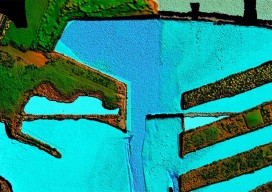
From Shore to Floor
Today’s technology records depth from land to deep waters accurately and efficiently. More than 90% of the world’s trade is carried by sea, according to the International Maritime Organization. Therefore, accurate and up-to-date charts of coastal waters for ship navigation are vital for world commerce. The current expansion of the Panama Canal, which will double...
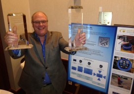
Visual Intelligence Takes Top MAPPS Honors
By xyHt Visual Intelligence captured the Grand Award at the 8th annual MAPPS Geospatial Products and Services Excellence Awards ceremony. The award was presented at the 2014 Geospatial and Engineering International Marketing Conference in Alexandria, Virginia on September 25, 2014. A software and sensor technology company based in Houston, Texas Visual Intelligence won with their...

Imaging Rover on the Canal
A Florida surveying company puts a new technology to the test on an historic canal fronted by 21 subdivisions. Editor’s note: The announcement of the Trimble V10 imaging rover in late 2013 was greeted with a mix of excitement and questions (“what is it?”). With close-range photogrammetry just beginning to reach the toolboxes of surveyors...

Q&A with 3D Guru TJ McCue
Autodesk is sponsoring an eight-month 3D RV (recreational vehicle) 100 stop tour of the U.S. that celebrates the future of how things are designed and made. Led by TJ McCue, host, writer, and 3D enthusiast, the 3D RV tour is visiting America’s cities, towns and off-the-beaten path byways to explore a powerful and fundamental change...

Drone Art: Art Meets the Science of UAS at Elevated Element
Our company, Elevated Element, uses UAS for aerial photography. Our monuments capture project came about when we were contacted by Direct Dimensions, a 3D modeling firm, with the idea of combining the techniques of aerial UAS photography and digital 3D scanning. We chose the Francis Scott Key Monument in Baltimore’s neighborhood of Bolton Hill because...