Category Archives: Spatial IT/GIS
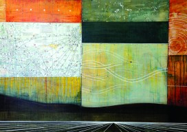
GeoArt: Velocity Made Good
All of her artworks, says Perri Howard, “involve the relationship between human perception and sense of place.” Sculpture, painting, drawing, writing, and sound are some of the mediums with which Perri Howard expresses her spatially inspired art. The name of her studio is a nautical term: “Velocity Made Good,” which means the element of a...
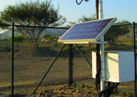
Mobile System Alerts Dubai Drivers of Approaching Sandstorms
Periodically, large sandstorms and low-visibility conditions wreak havoc in the Middle East, with potentially deadly consequences for drivers. In 2007, a sandstorm in Saudi Arabia caused a pileup involving about 80 cars. In 2008, low-visibility conditions caused a 200-car pileup on the border between Dubai and Abu Dhabi, killing about 25 people. In April 2012, a...
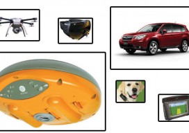
An Intro to Internet of Things
Internet of Things and Internet of Where-Things-Are Your field measurement instrument is connected to the internet as is your data collector; plus your phone and perhaps your watch; your home’s thermostat, security system, and lighting; your television, game consoles, entertainment system; your car, your kids, maybe even your dog’s collar; and soon, too, things like...
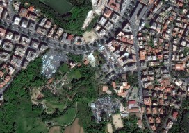
New Markets for Satellite Imagery
In June, the U.S. Department of Commerce, granting a request by DigitalGlobe, gave the company permission to sell its imagery at the best resolutions available from its current constellation. Additionally, six months after its new WorldView-3 satellite is operational, DigitalGlobe will be permitted to sell imagery at a resolution of up to 0.25 meters panchromatic and...
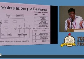
FOSS4G 2014
If you’re seriously into open source GIS, you were (or should have been) at the FOSS4G (Free and Open Source Software for Geoinformatics) international conference held September 8-13 in Portland, OR. An annual event since 2006, FOSS4G is large enough to attract the heavy-hitter vendors (e.g., Google, Amazon and Boundless), yet small enough to enable...
Critical Issues for GIS/Survey Cooperation
State Plane Coordinates in Legal Descriptions The time is now to have State Plane Coordinates (SPC) attached to key monuments that should be part of just about any legal description, in the proper context.* This has been discussed since the early 1980s and has been accomplished only on a piecemeal basis. With coordinate inclusion, a...