In June, the U.S. Department of Commerce, granting a request by DigitalGlobe, gave the company permission to sell its imagery at the best resolutions available from its current constellation. Additionally, six months after its new WorldView-3 satellite is operational, DigitalGlobe will be permitted to sell imagery at a resolution of up to 0.25 meters panchromatic and 1.0 meters multispectral GSD. As of this writing, WorldView-3 is on schedule to be launched in mid- August from Vandenburg AFB on an Atlas 5 rocket.
DigitalGlobe currently operates a fleet of five Earth imaging satellites. Two of them—GeoEye-1 and WorldView-2—collect imagery at a resolution higher than 0.50 meters, and the company will be free to sell it at the highest native resolution. WorldView-3 has been designed to provide a resolution of 0.31 meters, and the WorldView-4 satellite, which is substantially complete, has been designed to capture imagery at a similar resolution. It is scheduled to launch in mid-2016 and provide 30-centimeter resolution imagery.
The relaxation of the resolution restrictions is specific to various spectral bands, explains Dr. Kumar Navulur, DigitalGlobe’s director of next generation products. The 0.25-meter restriction is only for the panchromatic (black and white) band, while there is a 1-meter restriction for visible and NIR bands because of the vast amount of information that they contain.
Prior to the U.S. government’s relaxation of its resolution restrictions, DigitalGlobe had to aggregate data from its GeoEye-1 satellite to a resolution of 0.50 meters; now it can sell it at its native resolution of about 0.41 meters. “Using a technique called pan-sharpening,” he points out, “we can fuse our color bands with panchromatic imagery and create a color image at 30 centimeters and sell it. However, if we want to sell the raw visible NIR data, we can sell it up to 1-meter resolution today with the resolution relaxation.”
DigitalGlobe plans to shift its WorldView-1 satellite into a different orbit in which it will image Earth in the afternoon local time each day. Customers will be able to access images of a particular area with multiple satellites in the morning and again with WorldView-1 in the afternoon, thus providing consistent views of Earth over much of the day.
The imagery’s higher resolution will open up new markets for the company. DigitalGlobe optimized WorldView-3 for military, oil and gas, mining, agriculture, and forestry applications. “Those are the target segments that will be particularly well served by our new capabilities,” says Navulur.
WorldView-3 will carry a sensor that will capture eight short-wave infrared (SWIR) bands that provide information not currently available with DigitalGlobe’s existing constellation. SWIR sensors capture imagery at 1.2 micrometers, 1.6 micrometers, and around 2.2 micrometers, and WorldView-3 will cover all three of these SWIR imaging windows. “We also have continued on WorldView-3 the same eight bands that we have on WorldView-2, but at a higher resolution,” Navulur points out.
New Applications
Imagery from the new satellite will enable many applications that are not currently possible. One concerns geology. “The SWIR band contains unique signatures about various minerals that you cannot see in the visible and IR parts of the spectrum, which is what most of the satellites have today,” says Navulur. In addition to identifying these “pathfinder” minerals, the SWIR bands on WorldView-3 will also enable the oil and gas industry to detect carbon seepages emerging from the surface.
For agricultural applications, SWIR at 2.2 micrometers resolution makes it possible to detect the amount of crop residue left behind after a crop is harvested, providing farmers with key information to make decisions about whether and how to till the soil. “The reason people leave the crop residue behind is to prevent soil erosion in the wintertime and to protect the field,” Navulur explains. “So, there are best-management practices that tell you the percentage of crop residue to leave on the field.” At 1.6 micrometers, the SWIR sensor on WorldView-3 will make it possible to see whether an agricultural field contains sufficient moisture.
The visible and NIR bands give great information but also contain a lot of atmospheric noise because they are affected by aerosols and water vapor, which are constantly changing. SWIR, however, minimizes this noise. “Now we can actually start differentiating between different types of crops using the SWIR bands as well as the visible and NIR bands,” says Navulur. “Our informational accuracy greatly increases by using the capabilities of all of the 16 bands on WorldView-3.”
Similarly, for forestry applications, the SWIR band makes it possible to differentiate between, say, an oak tree, an aspen tree, and a pine tree. It also makes it possible to detect very early when trees are affected by infestations, such as the pine beetle. While this is already possible using the red and yellow bands on WorldView-2, WorldView-3 will have the same bands but at a higher resolution.
A unique feature of WorldView-3 is a sensor for atmospheric correction, called CAVIS, which stands for clouds, aerosols, water vapor, ice, and snow. It will allow for automated information extraction on a global basis. “Today, if I collect an image of Longmont, Colorado, and come back a week from now and collect another image, because the atmosphere is changing it is really difficult to write an algorithm and tell it to find a particular object,” says Navulur. “WorldView-3 will be able to measure the atmosphere, compensate for atmospheric noise, and correct and calibrate the imagery. This will allow scientists around the world to start writing algorithms to, for example, find a type of oak tree anywhere across the globe. As long as the feature has the same response, we can now write these algorithms or allow the scientists to do the same thing. That is very exciting.”
The aerial photography industry’s sweet spot for collecting imagery has been one foot. For more than a decade, however, many state and local governments have been using 30-centimeter imagery to do urban planning and identify such features as sidewalks, manholes, rights of way, or vents on roofs. WorldView-3, Navulur says, will be able to provide that type of imagery across the globe, including in areas where aerial imaging is not permitted. In particular, it will help meet growing demand for identifying locations for solar panels on roofs. “Now, at 30 centimeters, we can provide globally the solar potential of the roof tops.”
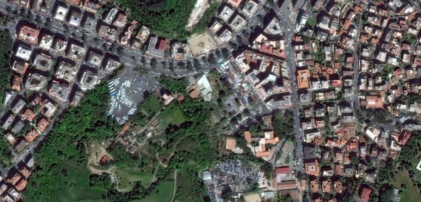
Image courtesy of DigitalGlobe. Pictured is a 50cm resolution image of Rome, Italy in 2011.