Category Archives: Surveying
Flatdog Media
Flatdog Media publishes xyHt print and digital magazine, a blog, and two enewsletters. We’re comprised of a small staff; our office is in Frederick, MD but our writers and editors live and work internationally. Click on each name for bios, photos, and articles for and about staff members. Publishing Staff Neil Sandler, Publisher Shelly Cox,...
xyHt: A New Magazine
Like so many ideas in surveying, starting this magazine started over a beer at a great little Irish pub with friends, where we discussed what the landscape of surveying might look like in the not-so-distant future. I figure, during the course of almost 50 years that I’ve been a geodetic surveyor, virtually all parts of...

xyHt: What Does It Mean?
Why did we pick an obscure geodetic expression as the name of our magazine? It’s not all that obscure—it represents a foundational element requisite to nearly all human endeavor. It touches your life explicitly and in the abstract. All of the ways that humans have measured and gauged their world, each of the conventions they...
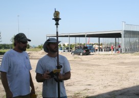
Going Smaller to Grow Bigger
Editor’s note: Some of the more significant changes in workflows and data management in surveying field and office operations have come in recent years: a move to mobile, robotics, and cloud-enabled software suites. But, how has implementation played out? We offer the following case study of a forward-thinking surveying and mapping firm that has implemented...
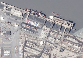
The New Spacescape
Small satellites are changing who dominates the field of satellite remote sensing. Move over military and government policy and regulation. Make way for private companies and even the public. There are big changes afoot in the satellite remote-sensing field: improved technology as well as regulatory shifts enabling the application of this technology (see “New Markets for Satellite...
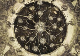
Model of a Fiery Earth
This copper engraving entitled “Fire Canals” is an early 3D diagram of volcanology; it’s a cross-section of the Earth showing volcanoes on the surface forming from a molten magma core. Note the ships sailing between erupting volcanoes, blown by the four winds. This model was created by the Jesuit scholar and polymath Athanasius Kircher (1620 –...