Striking the right balance in building national cadasters with private/public partnerships.
Land ownership is a foundation of national economies: those who have land titles can use them to obtain credit (which is often essential to start and expand businesses), and property taxes are a key source of government funding. Therefore, authoritative and efficient land registries are essential for economic development.
Yet, in many countries land registries are archaic and inefficient, making them a source of corruption and abuse. Conversely, efforts to develop modern cadastres sometimes result in overly expensive and complex systems.
UN Awareness of Geospatial Technologies
At the end of February 2015, the General Assembly of the United Nations adopted a resolution calling on member states to develop a global geodetic reference frame for sustainable international relief and development (see “A Global Geodetic Roadmap” in the May issue of this magazine). The resolution urges governments to voluntarily implement the open sharing of geodetic data, standards, and conventions and invites them to improve national geodetic infrastructures and to engage in multilateral cooperation that addresses infrastructure gaps and duplications towards the development of a more sustainable geodetic reference frame.
“Professionally, I don’t see it as a game changer,” says Dr. Keith Clifford Bell, senior land administration specialist in the Global Land and Geospatial Unit at the World Bank. “For geospatial information, and especially in terms of geographic positioning, most countries have been using WGS 84—a standard for use in cartography, geodesy, and navigation—for the past couple of decades, and many countries have invested, or are investing, in converting existing mapping and producing new mapping on WGS-84-based systems anyway. So, some would suggest that the UN is arriving at the party very late!”
However, he thinks that the UN resolution is good “as a vehicle for raising awareness.”
Rare Geospatial PPPs
Throughout the world, public-private partnerships (PPPs) are very common, especially for infrastructure projects such as water, telecommunications, roads, and ports. This arrangement is still rare, however, when it comes to geospatial technologies and data, including land registries.
“For sure,” says Bell, “many governments may outsource the delivery of certain services and functions to the private sector or to state enterprises, but that is more in terms of purchaser-provider, rather than PPP. Most definitely I do see opportunities for PPPs in geospatial services and land administration systems of governments, but it is the choice of governments, which must be ready and capable of adopting such approaches.”
Some countries, Bell points out, are investing huge amounts in old geodetic systems or in more modern CORS systems, while others have large national mapping programs using satellite imagery acquisition. He wonders why some governments decide to build such systems entirely on their own rather than establishing PPPs or outsourcing some of the work to minimize costs and capacity issues.
From the perspective of the government of a country, he says, whether to go into geospatial PPPs or outsource geospatial functions or services depends in part on whether it has the requisite skills to ensure that the country is getting good value for its money and that it is the best model for delivering the required service.
“Is outsourcing to the private sector the best approach? How many actually market-test for outsourcing or for PPPs up front before making a policy decision on how to do it? The choice is more complex than may at first meet the eye,” says Bell.
For the government of a developing country, the choice also depends on whether it has the capacity to oversee a PPP or an outsourced project from the technical, financial, legal, and policy perspectives—to set policy and to write and enforce regulations.
“Simply to go out to a private sector arrangement, without really knowing what you are doing, being aware of the options, having done no market testing, undertaking no due diligence—is at best high risk and at worst clearly folly,” says Bell.
“On the other hand, for an informed government, there are huge advantages if the appropriate services are to be outsourced or delivered under a PPP. One obvious benefit is that it doesn’t need to have huge human resources tied up in these things—especially when more often than not they lose those human resources to the private sector, which pays better. Other benefits are technology upgrades and maintenance. It can mean that governments don’t have to tie up limited funding in capital that the private sector can invest in.”
Land Registries Are Special
Because land ownership is a key to much economic and political power, land registries are very sensitive. Therefore, there is disagreement as to whether cadastres are a good subject for PPPs. According to Bell they never are. Brent Jones, land administration industry manager at Esri, believes that they are in certain circumstances, and Abbas Rajabifard, a professor at the University of Melbourne, Australia, strongly supports the arrangement.

Dr. Keith Bell, senior land administration specialist at the World Bank.
Bell says, “I remain unconvinced that a land registry can operate as a PPP and fulfill all public-sector obligations and deliver accessible, affordable services to the poor and ensure good land governance. Perhaps a CORS network can be funded similarly to a toll road—through user fee-for-service. The private operator derives revenue from the fees paid, which covers operating costs, capital improvements, and profits. But I don’t see a land registry being able to operate like a toll road.”
“Land is really different,” says Jones, “because land cadastre, land registry, and land tenure all require many different institutions. There are institutions that tell you what you may and may not do with your land; there are the institutions that defend your rights based on some kind of documentation; there are the institutions that allow for the development of your property; and there are some legal institutions that allow for you to heir and will your property to your descendents. However, that doesn’t mean that there isn’t a place for PPPs.”
Many infrastructure projects, such as water, have a clear pay-for-use revenue model, he points out. “With land, it is not as clean a story as with infrastructure, but there are elements of land that do lend themselves to PPPs.”
In many countries, Jones explains, the rule of law does not prevail, and a paper title does not protect property rights. Where there is a large backlog of titles, bribes often determine which make it to the top of the stack. “One way to eliminate corruption is to make that stack go away,” he says.
In industrialized countries, large cadastral systems produce geospatial products and can sell them, he points out. Therefore, they can establish PPPs with private companies that can help them build their commercial products in exchange for a slice of the revenue. “However, this is not possible in countries where data is not shared freely, where the cadastre system owns the data, which is quite common in many parts of the world.”
“Building a spatial data infrastructure is not purely a technical exercise,” says Rajabifard. “It is a socio-technical and a socio-economic exercise.” Worldwide, he points out, only 30 to 40% of land parcels are registered. Recent advances in crowdsourcing technology that enable the collection of volunteer geographic information (VGI) could help register the rest.
Building Successful Cadastres
Building a new national cadastre is a technically and politically challenging project. Many such projects fail. One reason, according to Jones, is that they bite off more than they can chew. “Successful cadastre systems throughout the world have evolved. New requirements arise, and the systems are adapted and modified. We know enough about technology now that we don’t have to rewrite those systems. We need to figure out what works and what can scale.”
Esri uses open source, Jones points out, and it is part of many solutions, but it is generally not used for land systems. “When open source is a core component, systems don’t work. In the developing world, it is not going to work, because there is no access to programmers. They need something that they can turn on and it works.”
Instead, Esri relies on an open standard called the Land Administration Domain Model. “Many projects fail because they do not adhere to some good standards that are out there. They are writing things and reinventing the wheel all the time. So, let’s adopt some open standards and let’s use the tools that people have in their pocket.”

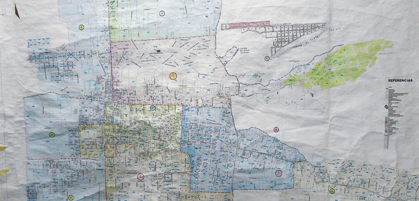
Without adequate cadastral records, proper land planning is impossible, resulting in sporadic, unplanned, and often dangerous development, where the poor are left out of the economy.
One way to lower the cost of developing cadastral systems in developing countries is to take advantage of cheap consumer mobile devices. Esri is using Collector, an app it developed that runs on an OS for Android and is designed to consume a feature service. In Vietnam, Jones points out, Android phones can be bought for as little as $20.
“So, all we really need to do is take a feature service, host it in the cloud, and we have a data collection tool. Because it is in ArcGIS Online, we have a data analysis, presentation, and management tool as well. So, we are leapfrogging over all that stuff to build a cadastral system. We can take a centimeter-grade position from any device that outputs Bluetooth and relay it to the Collector app on the Android.” This enables a $20 Android phone to collect survey-grade position data.
Dealing with Missing or Bad Data
Geographic information systems, like all computer systems, are only as good as the data they contain. “Putting into a GIS data of unknown veracity and quality without knowing the reliability of the sources poses a high risk,” says Bell.
“I am constantly making this point to people in the Bank and outside the Bank. It is also a big problem to integrate VGI with authoritative government data. I recall a case in an East Asian country with civil society organizations jumping up and down, saying that all the creeks, rivers, and roads, as marked on official government maps, were in the wrong places. Their hand-held GPS units couldn’t be wrong, they said, so the government’s national mapping agency had to be incompetent. As generalists, it would never have occurred to them to think about coordinate systems or map projections.”
When faced with missing or inaccurate geographic data in countries that have not yet developed modern geospatial systems, international agencies such as The World Bank have essentially two options. One is to assist governments in developing those systems. The other is to bypass national systems and rely on data from Earth observation satellites.
The best solution is often a mixture of both, Bell points out. “If an agency is satisfied that the information it has is no good or it may not be cost-effective to re-engineer it, then, of course, they should collect new data—if they have collect new data—if they have the funds. But throwing away information without going through that process is folly.”
Geospatial technology is one of the many areas of expertise that the World Bank helps governments develop. “Capacity building and institutional strengthening are very often key areas of development support across many sectors,” says Bell.
Fit for Purpose
The converse of inadequate geospatial technologies and missing or bad data are systems that are way more costly and accurate than required for their intended purpose. Many countries use traditional approaches to data acquisition through land surveying field methods, using electronic total stations.
“Land parcel boundaries are often surveyed to degrees of accuracy that are completely over-engineered,” says Bell. “Why place a mark when there is a perfectly good fence post, wall, rice paddy bank, tree line, or other natural or man-made feature that adjoining owners readily accept as being the boundary? So, why not use modern technologies such as rectified ortho-photo imagery stored on a tablet and take that to the field and allow adjoining owners to agree to where their respective boundaries are on the image? Most people have a natural spatial cognizance and can recognize ground features once oriented to the imagery displayed on the tablet.”
Jones agrees. When it comes to surveying land in developing countries, “we may not need a survey-grade position. We may just need something fit for purpose, and if the purpose is to delineate and document someone’s tenure, if we have people walking a line and agreeing, and we have some imagery, and we can see points on the imagery, we may not need GPS at all. We can just work with the lines of oc- cupation. We are building the wrong things for the wrong reasons and on the wrong end of the geometries.”
“Surveyors have been holding these systems back worldwide for a long time because of the survey rules and regulations on accuracy and monumentation,” says Jones. “You have land that is worth next to nothing, you have people living on it and deriving their livelihood from it; their families have been on it for three generations. Why do you need to have a centimeter-grade survey with 3-ft concrete monuments set to register that land?
“So, you need to move the positional quality to fit for purpose, and then you also need to move your technology to that as well. Don’t try to duplicate a Western world cadastral system. Understand how people are occupying and using land and what their tenure and relationship with the land and community is; document that with simple tools; keep it closed and secure within the community that needs to have access to that information; and let those institutions evolve over time.”
Some countries pour a lot of public resources into building their own national CORS or other systems that the private sector could perhaps be building more efficiently, freeing up taxpayer money for other development projects. “It is a very serious problem,” says Jones. “So much money is spent on building these systems, and they don’t work.”
The goal, he argues, is to build a foundation model “that will help people not build things over and over and will allow the commercial community to build tools and applications on top of that model that can be used more than one time, in different countries.”
Fit for Purpose Case Studies
Keith Bell highly recommends a joint publication by the World Bank and the International Federation of Surveyors (FIG) titled Fit-For-Purpose Land Administration, which presents many case studies. Bell co-authored the publication with Professor Stig Enemark and two other joint authors and was the only author from the World Bank.
The publication, he says, “has achieved strong support globally, and key international agencies like UN-Habitat and the Food and Agricultural Organization (FAO) have cited it as best practice. Adopting the FFP principles can really be a game-changer for governments investing in land administration and geospatial information.”
Getting It Right
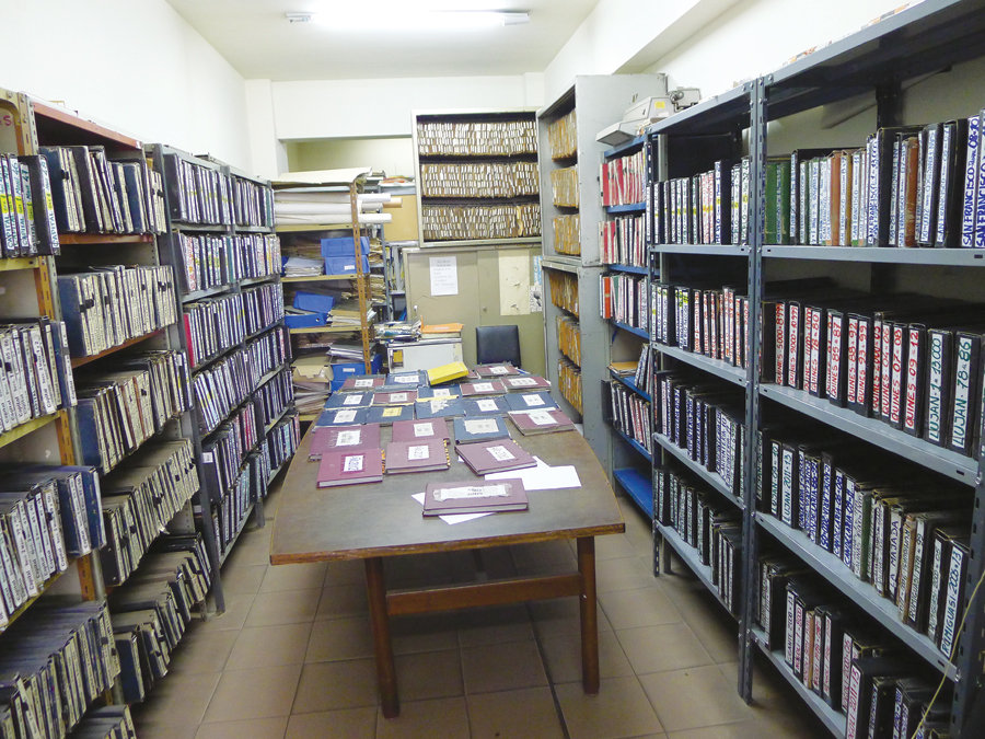
Cadastre offices like this one in Haiti, with cadastre maps in typically poor condition—inaccessible information, unindexed and incomplete—can experience a quantum leap in efficiency by converting records into a digital system.
When asked for an example of a country that built a national cadastre the right way, Jones cites Rwanda after the genocide. “First off, they had a lot of money. Second, it was a small country. They just did it, and they are starting to see some benefits from that.” He also points to Australia and most of the Western European countries.
By contrast, he points out, some countries have developed hard-coded custom systems. “The problem with that is that in ten years, companies are out of business; they get acquired by somebody else; technology changes rapidly. So, there you are, stuck, and you have to re-build it.”
What is the right model? “We’re now focusing on the idea of publishing services, and consuming services on devices, and mashing those services together in Web maps and applications,” says Jones. “So, as these systems grow, we can publish and consume more services. Services allow us to keep our agencies and organizations independent but still share data. I can update the registry before I have to update the cadastral mapping system. I can update the cadastral mapping system and still get data from the registry.”