Category Archives: Surveying

Model of a Fiery Earth
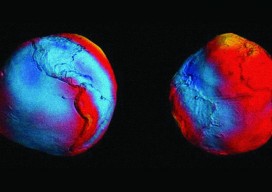
This copper engraving entitled “Fire Canals” is an early 3D diagram of volcanology; it’s a cross-section of the Earth showing volcanoes on the surface forming from a molten magma core. Note the ships sailing between erupting volcanoes, blown by the four winds. This model was created by the Jesuit scholar and polymath Athanasius Kircher (1620 –...

How May I Assist You?
Support Agent THX1138: Hello, and thank you for calling GenericGeo, world leader in innovation, synergy, integration, empowerment, and creative solutions for your Geo world. Ask me about our gluten-free geomatics products. This is support specialist agent number THX1138. How might I direct your call? Caller: The screen and keypad fell off my data collector. 1138: So,...
Not Always Better With Age
Some things get better with age; some do not. Surely this is true for wine, but not sake or unrefrigerated shellfish. In the past we would view something that was made or had been established years past as holding invariant weight or authority. This was often because the effort to make or establish the item...
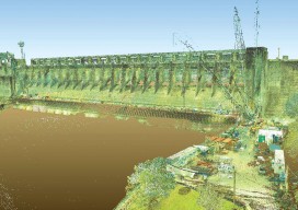
Capturing the Bluestone Dam
Above: Bluestone Dam is a concrete gravity dam located just upstream of the confluence of the New and Greenbrier Rivers near Hinton, West Virginia. Editor’s note: Because the Bluestone Dam is critical infrastructure, the Corps cannot display images of its insides. In fact, security is one of the key reasons it didn’t contract out the...
One Center ¼
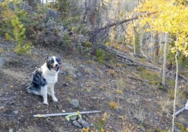
Igor Kidinsky, known as Eager (the Kid), was breathing hard after such a rough hike, and he wondered how Glenny Dale, or Glutton (the Old Man), would make it back to the truck, because the return hike would be uphill. Fall had turned the Quaking Aspen into a shimmering yellow that seemed to flood the...
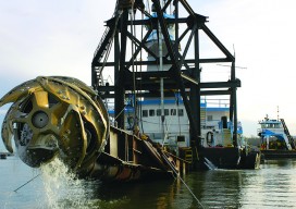
Survey. Dredge. Repeat: Keeping the Columbia River Navigable
As the skipper of Galileo 3, a 30-foot sailboat on the Columbia River, I tell my crew that I am comfortable with 15 feet of water under the keel, get nervous when it drops below 10 feet, and take immediate action if it drops below 6 feet. That’s because I cannot constantly monitor my chart...