Category Archives: Surveying
Boundary Lines: When a Fence Appears in the Middle of your Street
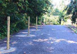
In early July 2014, the residents at the end of Eastside Drive, a tranquil community of lakeside homeowners in Cobb County, Georgia, were perplexed to see workers installing a fence, ostensibly down the middle of their paved road. When the fence was completed, and where homeowners once enjoyed the ability to back up their vehicles...
Transformation of Observations, Part 3
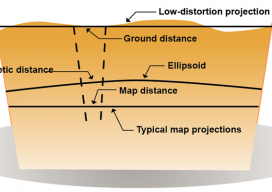
Above: Typical and low-distortion map projections. Using a Project Factor In Part 1 of this series of articles (September 2014 issue), I explained how to transform surface observations into a geocentric coordinate system so that it could be compared to GNSS baseline vectors. In Part 2 (December 2014) I explained how the creation of a...
ASPRS Engages States
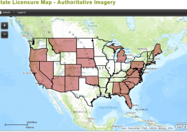
Above: State Licensure Map – Authoritative Imagery ASPRS Launches New Initiative to Engage States as They Consider Regulating Photogrammetry under Existing Surveying Laws At the American Society for Photogrammetry and Remote Sensing’s (ASPRS) November 2014 fall conference in Denver, Colorado, ASPRS announced its “Licensure Plan for the State Licensing of Photogrammetrists” initiative. ASPRS recognizes an immediate...

Infrastructure Gets a C from COGO
Former governor says U.S. spatial data leadership has slipped. The nation’s spatial data infrastructure gets a barely passing grade of “C” indicating it “requires attention,” former Governor Jim Geringer (R-WY) reported on February 23. Speaking at a news conference at the National Press Club in Washington, Geringer said the national spatial data infrastructure (NSDI), a...
The Note
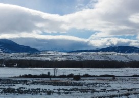
From this crest of the Grand River Basin, near Byers Canyon, Colorado, the survey crew of Igor Kidinsky, aka Eager (The Kid), and Glenny Dale, aka Glutton (The Old Man), can view the same grandeur as the first survey crew who stood here 130 years ago, imagine the same thoughts, and make the same notes:...
Surveying
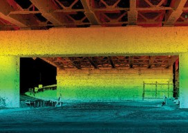
Above: This bridge in Baltimore took 1 hour and 45 minutes to scan: 550 feet of roadway or 1.5 acres, including all the beams for the underside of the bridge for clearance and engineering design. Reality Capture, Targetless Registration, the End of Dedicated Field Crews As I stood in a courtyard of the Walter Reed National...