





Top Stories
Get your top stories below
The Construction Automation Continuum
It’s more about many minor triumphs than major leaps. Surveyors can play an essential role in implementing these changes To ...

xyHt Weekly News Recap: 03/03/2023
Bentley Systems Announces Retirement of Founder Keith Bentley First Autonomous Agricultural Drones Launched in Thailand Improved Location Accuracy Enables Hydraulic ...

Bridge Watchers
Smart sensors and satellites are being used to actively monitor bridges and large infrastructures. With eyes in the sky and ...

Directory – Surveying Firms
McKim & Creed 919-233-8091 Website: www.mckimcreed.com Offices located throughout North Carolina, South Carolina, Georgia, Florida, Texas, and Virginia ...

Construction on the Move
Looking Forward From the very first construction project (possibly the addition of an extra room on to a Neanderthal cave) ...

xyHt Digital Magazine: March 2023
xyHt’s March issue focuses on construction and the geospatial technologies that are changing the way we build things. As always, if ...

Why Serving as an Expert Witness Makes You a More Competent Land Surveyor
In my personal experience, many land surveyors that are contacted by attorneys decline the opportunity to serve as an expert ...
xyHt Weekly News Recap: 02/24/2023
2023 NSPS Day on the Hill FIG Working Week in Orlando Registration URISA Exemplary Systems in Government Awards Open NV5 ...

Hydrospatial: The Next Frontier of Hydrography
Staying Fluid The theme for US Hydro 2023 reflects the relevance that our profession and related sciences have in the ...
Legal Boundaries: Deed Interpretation
Last time around we discussed the Rules of Construction, court-made rules for the interpretation of written documents when they are ...
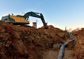
Safety Underground
Prostar and KCI Technologies look beneath the surface to save time and money The devil is in the details of ...
xyHt Weekly News Recap: 02/10/2023
Turkey Earthquake Prompts United Nations to Activate Emergency Satellite Mapping Golden Software Adds Powerful New 3D Subsurface Visualization Functionality Geo ...
