


Top Stories
Get your top stories below
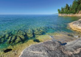
Topobathymetric Lidar Tackles Great Lakes Coastal Mapping Project
The Great Lakes Restoration Initiative is an effort to protect and restore the largest system of fresh surface water in the world—the Great Lakes. As a part of this initiative, the National Oceanic and Atmospheric Administration (NOAA) has an ongoing effort to update all its bathymetric maps in the Great...
Pioneering for Tomorrow
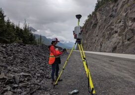
The role of laser scanning in shaping our resiliency to natural hazards

xyHt Weekly News Recap: 05/3/2024
Protecting Global Supply Chains from Cyber and Kinetic Attacks Airbus Expands Earth Observation Constellation with Pléiades Neo Next Mapping Global Flash Drought Trends for Disaster Preparedness AlphaGeo Launches AI-powered Geospatial Platform to Future-proof Global Investing Amsterdam Drone Week 2024 Defines a New Paradigm in Aviation Pix4D Releases Enhanced PIX4Dcatch 2.0...