from Nadir to Oblique
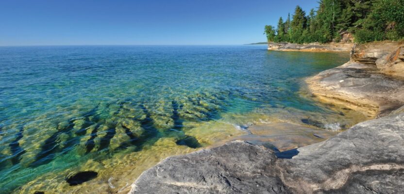
The Great Lakes Restoration Initiative is an effort to protect and restore the largest system of fresh surface water in the world—the Great Lakes. As a part of this initiative, the National Oceanic and Atmospheric Administration (NOAA) has an ongoing effort to update all its bathymetric maps in the Great Lakes region, including advanced maps of the marine environment.
This requires acquiring accurate digital elevation models (DEMs) and reflectance data. The updated information will aid in enhancing the understanding of the Great Lakes hydrography and ecosystem.
Tetra Tech, Inc., a provider of advanced consulting and engineering services, acquired a Teledyne Optech CZMIL SuperNova Topobathymetric lidar system to provide data for this effort. Tetra Tech chose the CZMIL SuperNova system for its superior depth penetration and high-density mapping capability.
Topobathymetric lidar enabled mapping of the lakebed to a maximum depth of 31 meters. The intensity raster product, constructed with input from NOAA, served as a valuable tool for benthic (lake floor) habitat modeling and the full waveform data will contribute to further research questions. At the end of the project, Tetra Tech delivered classified point clouds and gridded products.
“The CZMIL SuperNova enabled Tetra Tech to exceed the project’s density requirements, achieving approximately five points per square meter for bathymetric bottom density and an impressive 89 percent bathymetric bottom coverage across the area of interest,” said Renee Walmsley, vice president for Tetra Tech Geomatics and Remote Sensing. “Tetra Tech is dedicated to continuous improvement and innovation in bathymetric lidar technology and is enthusiastic about exploring diverse environments worldwide, leveraging the CZMIL SuperNova system’s capabilities.”