Ready or not, here they come.
Considering all of the outreach that the National Geodetic Survey (NGS) has been doing for the last couple of years, hopefully most of you are well aware of the National Spatial Reference System (NSRS) Modernization Project. That project will result in the replacement of both the North American Datum of 1983 (NAD83) and the North American Vertical Datum of 1988 (NAVD88) in 2022.
Plenty of excellent information can be found on the NGS website (as long as the government isn’t shut down) by clicking the “New Datums” icon on the NGS home page. We should all be educating and preparing ourselves for the coming transition, which we will have opportunity to contribute to, such as the GPS on bench marks campaigns to improve transformation tools.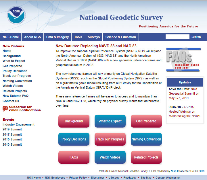
State Changes
In addition, though, 2019 is the year for us to get organized on the state level to determine what we would like to request for the world that we actually work in: State Plane Coordinates. I believe that 48 states have adopted a state plane coordinate system, all of which will be replaced during the State Plane Coordinates 2022 (SPC2022) project.
After a public comment period last summer, the final Policy and Procedures documents for SPC2022 will be released to the public in early 2019. These will be our playbooks for what and how we request our individual state plane systems.
Highlights of the Policy and Procedures documents include:
State-level stakeholder groups are identified by NGS. The groups are State DOTs (or other large State agencies in conjunction with the DOT), State GIS or cartographer offices, state professional surveying and engineering societies, state GIS/geospatial organizations, and academia. Requests will only be recognized by NGS from these stakeholder groups. If the state-level groups cannot arrive at a consensus request, then NGS will implement the default designs that they have already developed. States are to respond by December 31, 2019.
Only conformal map projections will be approved by the NGS. Examples, which are used for the current systems, are the Lambert Conformal Conic, Transverse Mercator, and Oblique Mercator.
Low Distortion Projections will be considered but must be designed by the state in accordance with the NGS requirements and submitted to NGS for approval.
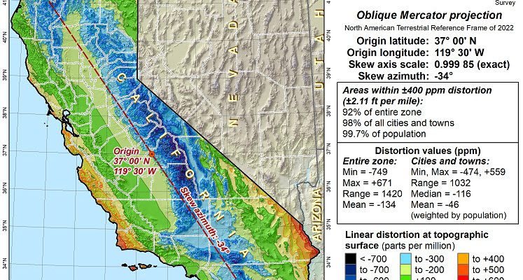
A “layered zone” option will be available, similar to what exists in Kentucky, meaning a state could have regional zones to minimize distortion for engineering and surveying applications and a single statewide zone for statewide or large regional mapping and GIS products. In California, we currently have six zones and likely will have something very similar in the SPC2022 system, but we may also have a statewide zone specifically designed to fit the state, rather than using other existing projections that do not fit the state well.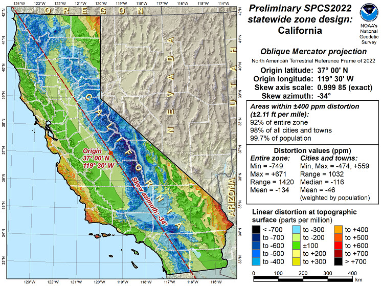
Update Webinar
Dr. Michael Dennis, NGS SPC2022 project manager, will be giving a webinar on January 10 to provide an update on the SPC2022 project, provided the federal government is up and running. Because the NGS site is currently down, I am unable to provide the link to register for the webinar, but please check their website as soon as things are back up and running to get registered.
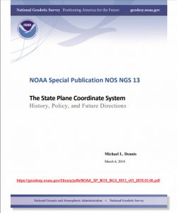
You can also find the recordings of the very popular webinars that Dr. Dennis gave in the first half of 2018 if you want to get the full background. He also authored an extensive document on the history, policy, and future directions of the State Plane Coordinate System in the U.S.: NOAA Special Publication NOS NGS 13.
States, Get Organized
What should states be doing now? The first thing is for the stakeholder groups to get organized, if they haven’t already. For example, the California GIS Council has established a SPC2022 workgroup to represent their interests. State surveying associations typically have work groups or committees, so they should be forming one for this project. Each of these groups should be reaching out to the others in their state, as communication will be critical if a consensus request is to be reached.
Remember that if your SPC system is defined in statute, what you request must be consistent with the statute language. If not, the statute language will need to be revised to accommodate. This includes the definition of what version of the foot a state uses.
Software Will Be Ready; Will You?
One critical component of this entire NSRS/SPC2022 project is that the NGS has already reached out to and sat down with commercial software developers/providers to help them get prepared for this transition. In the case of NGS-approved state plane 2022 systems for each state, the NGS will provide machine-readable definitions, which will simplify the addition to software products. So, our partners should have their products ready to go for us when the time comes.
Now is the time for us to decide our fate—if it differs from the default definitions that NGS has developed. Get organized, get engaged, and reach out to your fellow stakeholder groups. Your NGS regional geodetic advisor should help in connecting the various stakeholder groups. If you want very low distortion zones, be prepared to design them and submit to the NGS for review and approval.
The great thing about this phase is that it has a finite duration. Get your request in by the end of 2019 or accept what NGS gives you. Let’s get moving, folks.
Happy 2019!!!

This article appeared in xyHt‘s e-newsletter, Field Notes. We email it once a month, and it covers a variety of land surveying topics in a conversational tone. You’re welcome to subscribe to the e-newsletter here. (You’ll also receive the twice-monthly Pangaea newsletter with your subscription.)