Tag Archives: 3D

The Gamification of the Geospatial Industry
Why Is It Important? With huge, sprawling maps and realistic cities now appearing in our video games, it begs the question as to how these amazing cities render so quickly, yet we geospatial experts still sit waiting for 10 minutes for our software to open. For example, the notorious Grand Theft Auto: San Andreas (pictured...
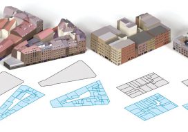
BigSUR
A software team creates a large-scale, structured, urban reconstruction system that handles multiple data sources with deep learning. Today, big data is ubiquitous: we have more information than ever, but combining and understanding all this data has become the challenge. This is particularly true for 3D cartography as we view our continually changing world with...
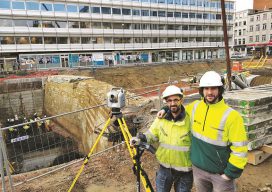
A New Line
Midway through a large and complex transportation project, a team of Belgian surveyors successfully adopted a new class of instrument. Hardware and software modernization doesn’t always yield immediate benefits for enterprises, and sometimes taking a particularly big leap or risk comes at a premium in time and labor. But sometimes everything goes smoothly. Our July...

Esri CityEngine: What Is It?
These past few weeks I’ve been trying to do some clever augmented reality stuff with Unity involving putting an object on the floor and ensuring it doesn’t wobble when you walk around it. (Yay for SLAM in mobile devices.) Although in software like Unreal and Unity you can download or buy models, what do you...
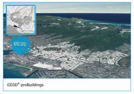
GD3D® Signs Innovative Data Agreement with CyberCity3D™ ahead of ArcGIS Marketplace Launch
(Cumbria, UK) January 23, 2018: GD3D® Signs Innovative Data Agreement with CyberCity3D™ ahead of ArcGIS Marketplace Launch PRESS RELEASE: GD3D®, the geospatial arm of Garsdale Design, is a leading 3D GIS consultancy based in Cumbria, United Kingdom. Today an agreement has been signed with CyberCity 3D Incorporated, a California 3D geospatial content company, to resell premium...
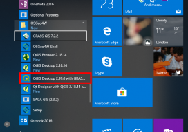
How to Use the New QGIS 3D
When QGIS revealed that they were going to add a 3D viewer, I was skeptical. Rumors were going around about it being a bolt on functionality and not really being fully adopted. To be perfectly honest, I was put off before there was anything to look at. As screenshots started to appear from Lutra Consulting,...