Tag Archives: aerial

Heights 2024
Click on the cover to view the Heights 2024 supplement to xyHt magazine. Articles in the issue include: Moving into the Future: A small Texas photogrammetry company adopted UAVs and is now taking its business to new heights. Modular Drone Sensor Payloads: The goal was flexibility. How Balko Technologies developed a truly modular solution that can evolve with the technologies and help...

Mapping for a Good Cause
When humanitarian emergencies strike, these volunteers are ready to share their geospatial skills and help communities map their way out of crisis. You, too, can lend a hand. After Cyclone Idai made landfall in Mozambique in the middle of March 2019, it left behind more than 1,000 casualties, miles of damaged roads, and ruined at...

xyHt Weekly News Recap: 10/20/2023
Trimble Donates $100,000 to World Food Program USA’s Erase Children’s Hunger Campaign Impressions of INTERGEO 2023 Hexagon expands TerraStar-X GNSS correction service to South Korea Geo Week 2024: Where Innovation and Transformation Converge Alfred State wins NCEES Surveying Education Award Trimble Opens Two Technology Labs at The Ohio State University to Advance the Next Generation...
xyHt Weekly News Recap: 10/13/2023
SOCOTEC’s European Projects to Benefit from Topcon Monitoring Technology CNH Completes Purchase of Hemisphere GNSS CentralSquare Technologies and DATAMARK Partner to Enhance GIS Data Mapping for Emergency Response Bringing Geospatial Context to the Metaverse: Considerations for the Next Steps Bluesky Aerial Maps Improve Efficiency for Forest Surveys Trimble Monitoring Software Expands Sensor Support for Broader...
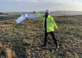
A Decade of Uncrewed Photogrammetry
Some might have had a peek at photogrammetry drones before 2013, but for me 2023 marks a decade since I first laid eyes on an uncrewed aircraft that “claimed” to do what I had been doing for years in bigger, more stable airplanes in the joyful company of pilots, copilots, camera operators, and navigators. In...
The Advantages of “Built Here”
There are reasons other than policy and security to consider domestically produced drones. Yes, when it comes to the drone market there is an almost “default” choice. Having established dominance, it further benefits from price by volume. And then they can invest more in R&D from the increased profits—if they choose to and do not...