Tag Archives: aerial

The Incredible UAV
Looking Forward Land surveyors aren’t just surveyors anymore. Map makers aren’t just cartographers anymore. We are all tied together in these geospatial professions of measuring, mapping, photogrammetry—anyone who collects and interprets data. We are ‘geospatialists.’ One of the things that tie all of us together is uncrewed aerial vehicles. A few years ago, who would...

Tackling the Aerial-to-CAD Bottleneck
Aerial capture is getting easier and faster, but the subsequent step of CAD linework generation is a bottleneck—especially given the present shortage of qualified drafters. AI is stepping in to help. In 2017, the co-founders of what would become AirWorks Solutions Inc. first met and began discussing ideas for a new geospatial venture. Both had...

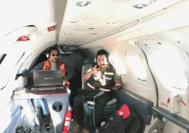
From Nadir to Oblique
Spic-and-Span Bridges Inspecting the world’s iconic bridges is becoming a UAV job When it was time last year to inspect the Sydney Harbour Bridge, the steel arc structure that spans the harbor of Australia’s capital, authorities Down Under turned to the latest technology available: drones. “The sky’s the limit when it comes to this technology....
The Future of Aerial Photogrammetry
Rapid advances in technology are changing the way we map from the air, but the 100-year-old technology of mapping by crewed airplanes will continue to fly into the future For thousands of years cartographers made maps using tools that mostly measured angles and distances, allowing for positioning of fixed objects over unknown topography. The earliest...
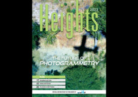
xyHt Magazine Heights 2023
Click on the cover to view the Heights 2023 supplement to xyHt magazine. Articles in the issue include: From Nadir to Oblique: From traditional airplanes to new-fangled gyroplanes, we take a look at several aspects of the aerial geospatial technologies that just keep getting better. The Future of Photogrammetry: While UAVs continue to emerge as aerial mapping vehicles, there...

xyHt Weekly News Recap: 03/10/2023
Geo Connect Asia returns in March to Singapore CONEXPO-CON/AGG Unveils World’s Largest 3D-Printed Statue Artificial Intelligence in Retail Market to Hit $85 Billion by 2033 Vexcel Imaging Receives Creative Content Award at 2023 Esri Partner Conference Recent NV5 Acquisition Axim Geospatial Awarded $9 Million in National Security Contracts Saildrone Completes World’s First Uncrewed Alaska Ocean...