Some might have had a peek at photogrammetry drones before 2013, but for me 2023 marks a decade since I first laid eyes on an uncrewed aircraft that “claimed” to do what I had been doing for years in bigger, more stable airplanes in the joyful company of pilots, copilots, camera operators, and navigators.
In 2013 I was hired by Trimble Navigation as director of geospatial sales for Latin America, and while reviewing the portfolio of products that I was responsible for, I saw a small black aircraft that looked more like a toy than a surveying tool. I spent a few minutes reviewing the features and performance details of the strange gizmo and told myself “Impossible!”
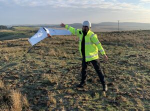
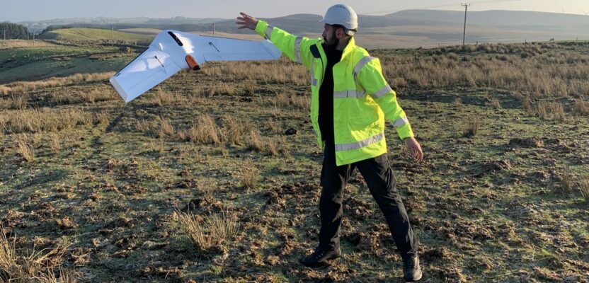
Soaring into the future, the Delair UX11 takes off with a simple Frisbee-like toss.
I remember calling my new boss and telling him there’s no way that little foam toy could do what a “real” aircraft could. He laughed, “I knew that a seasoned photogrammetrist like you would have doubts about drones in mapping, so I have arranged for a demo here in Denver, just for you.”
Before I knew it, I was in the desert outside Trimble offices in Westminster, Colorado, and the engineers in charge of the UX5 proceeded to launch the small, light vessel using a catapult. In less than 15 minutes the aircraft was gracefully back safely, and before the end of the day, we had a complete DTM, orthophoto, and contour-lines map of an area of about of about 50 acres.
“Here we go again,” I thought, having lived through the GPS revolution of the 90s, the laser-scanner craze of the 2000s, and the smartphone navigation invasion of the 2010s I was witnessing, once again, how my profession was being affected by miniaturization and new technologies.
In the span of a few short months, I found myself morphing from an incredulous skeptic to firm believer. My distributors in Latin America scheduled meetings with the different mapping agencies in every country, and soon we were selling the UX5 like hotcakes. One particular sale in Ecuador involved a demonstration in Antarctica when Ecuador’s Instituto Geografico Militar used the drone to map the country’s scientific research base in Antarctica. It would be one of the first times that a UAS had been used in Antarctica and the last time I doubted the capabilities of uncrewed aviation to perform excellent mapping jobs over small areas.
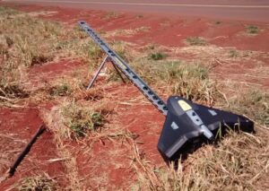
UX5 ready for action in the field
Now, 10 years later, the UX5 has evolved into the magnificent UX11 with a 59-minute flight endurance combined with a long flying range of 33 miles (53 km). It can map 300 acres (120 hectares) at 400 feet (120 m), with a resolution of 1.7 cm GSD.
In those 10 years a significant number of competitors entered the market with platforms as revolutionary as the VTOL Wingtra, the light and user-friendly SenseFly eBee X and, of course, the multiple offers by the behemoth in the industry DJI.
But the limitations of visual line of sight still exists for all manufacturers, and it creates the difference with crewed aviation, which can fly at higher altitudes and faster, making it impossible for drones to get even closer to the productivity obtained by traditional photogrammetry.
Now Delair, the current owner of the UX11, has announced that the new version of the mapping drone will be always connected through both a cellular connectivity (3G/4G) and a radio link with the Delair Link ground station. This means the UX11 will be one of only a few BVLOS-ready UAVs in the market.
Ready to launch, the UX5 drone was developed as an early photogrammetry UAV.
The key word in that previous statement is BVLOS (flights beyond visual line of sight of the operator) given that since the inception of Part 107 in the United States in 2016 most drone operations are regulated by a significant constraint that forces operators to keep the aircraft within visual range at all times. That has kept uncrewed aerial mapping from reaching its potential.
Therefore, the next big revolution is terms of uncrewed aircraft-based mapping is the possibility of flying beyond the visual line of sight of the operator. That means that for the first time there will be an even playing field for both crewed and uncrewed aviation. But the question is, will it really make a significant difference?
As usual, the answer is both yes and no. On the yes side we find that advances in battery technology and hybrid energy models will allow drones to fly longer and perhaps higher, allowing for larger areas and the inevitable erosion of the market share of crewed aviation. The flip side of that equation is that even doubling the flying times and increasing flying altitudes to thousands of feet, it will be difficult, with current technology, to match the performance of a turbocharged Piper Aztec or a Citation Jet.
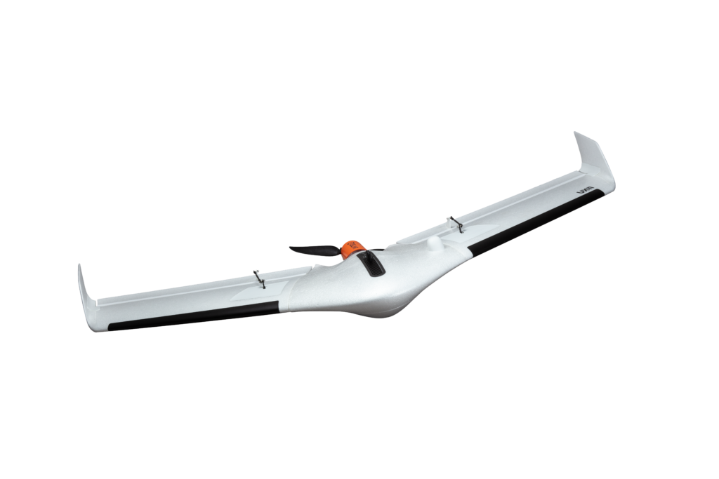
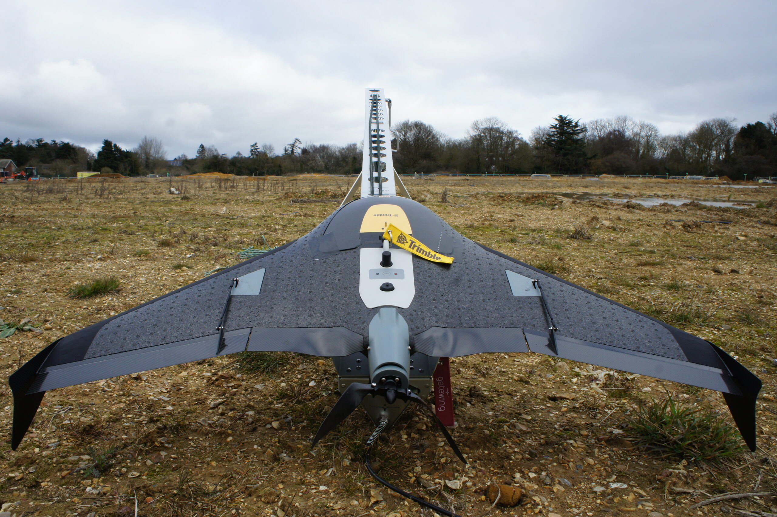
The Delair UX11, a state-of-the-art photogrammetry drone.
In other words, for uncrewed aviation to reach the same levels of productivity and efficiency of crewed aviation, drones will have to grow considerably in size and endurance and the regulations will have to allow for uncrewed aviation to occupy the same airspace as commercial air traffic.
Even though we don’t see these changes happening anytime soon, it is not outside of the realm of possibility that one day all aviation will be uncrewed, and the levels of automation will allow for both crewed and uncrewed aviation to share the same sky. In the meantime, land surveyors and photogrammetrists alike will continue to use the right tools for the job, from small pieces of land with uncrewed aircraft to sophisticated offshore jobs with crewed jets. The sky is the limit, no pun intended.