Tag Archives: geospatial

xyHt Weekly News Links: 12/15/17
Transducers USA Introduces New Custom Ultrasonic Sensors Global Aerial Imaging Market – Expected to Reach $3.2 Billion by 2023 – Research and Markets Maptek unveils new strategic panel caving application Is the Newly Revised Geospatial Data Act Worth Supporting? Phase One Industrial Releases iX Capture 3.0 Software for Aerial Photography Geomni Capturing Aerial Imagery of...
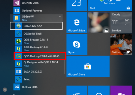
How to Use the New QGIS 3D
When QGIS revealed that they were going to add a 3D viewer, I was skeptical. Rumors were going around about it being a bolt on functionality and not really being fully adopted. To be perfectly honest, I was put off before there was anything to look at. As screenshots started to appear from Lutra Consulting,...
xyHt Weekly News Links: 11/24/17
Topcon Agriculture announces TAP, a connected agriculture ecosystem Trimble’s 3D laser scanning and modeling offers a new way to conduct storage tank inspection in the oil and gas industry Carlson 2018 Precision 3D Topo Geospatial Data Act Save the Date for Feb. 5-7, 2018, Co-Located with ASPRS!
xyHt Weekly News Links: 11/3/17
Garmin® acquires Navionics® SimActive Automates Direct Georeferencing GeoSLAM Launches Time & Cost Saving 3D Mobile Laser Scanners at Dallas Fall BIM Forum 2017 Singapore International Robo Expo Returns Bigger in 2017: Showcasing Latest Robotics Innovations USDOT launches Drone Integration Pilot Program Velodyne LiDAR and BoE Systems Partner for Integrated UAV-Borne LiDAR in Geospatial Data Collection
xyHt Weekly News Links: 9/29/17
Teledyne Optech and IGI announce new cooperative agreement and first product offering Hemisphere GNSS Debuts Next-Generation S321+ and C321+ GNSS Smart Antennas Septentrio unveils the new Altus NR3 at InterGEO GeoSLAM Launching Enhanced SLAM Software and Next Generation Mobile Scanner at InterGEO 2017 INTERGEO 2017 Berlin: Geo-IT-event officially opened Applanix Announces POSPac Cloud for Mobile Mapping...
xyHt Weekly News Links: 8/4/17
Dewberry Honored for Special Achievement in GIS Reps. Westerman and Moulton Introduce Bipartisan Geospatial Data Act | Congressman Bruce Westerman GeoCue Announces GNSS Direct Geopositioning System for Low Cost DJI Drones Nearmap Provides High-Rez Oblique Imagery and 3D Products in Ready-to-Use Service ILMF Call for Papers Deadline is August 14! Congressman Doug Lamborn Addresses MAPPS...