Part 1
We attended remotely the ESRI User’s Conference (UC) held in San Diego on July 10th and, for the first time, saw and heard how the leading commercial GIS software company in the world positioned itself for the use of AI in its products. It is reasonable to assume that AI can make GIS and spatial thinking accessible to everyone at levels not imagined before, but this can only be possible if—and only if—we have ESRI, the leader of the industry on board.
This is what we plan to explain in this first installment of a three-part series about the complex relationship between AI and GIS. In the next two issues we will bring experts to help us explain “How AI Can Benefit GIS” (Part 2) and then “What GIS can do for AI” (Part 3).
The ESRI Position
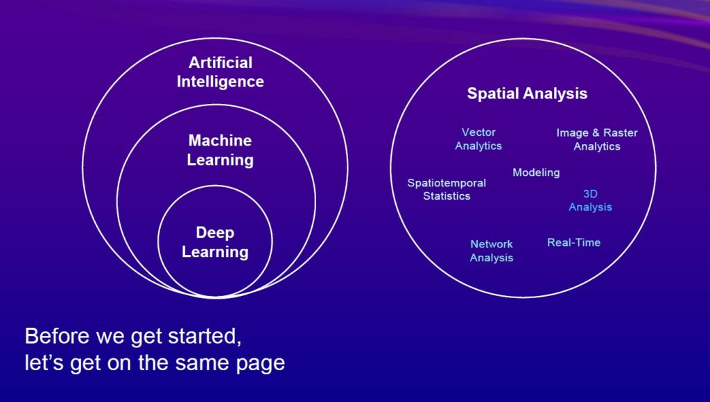
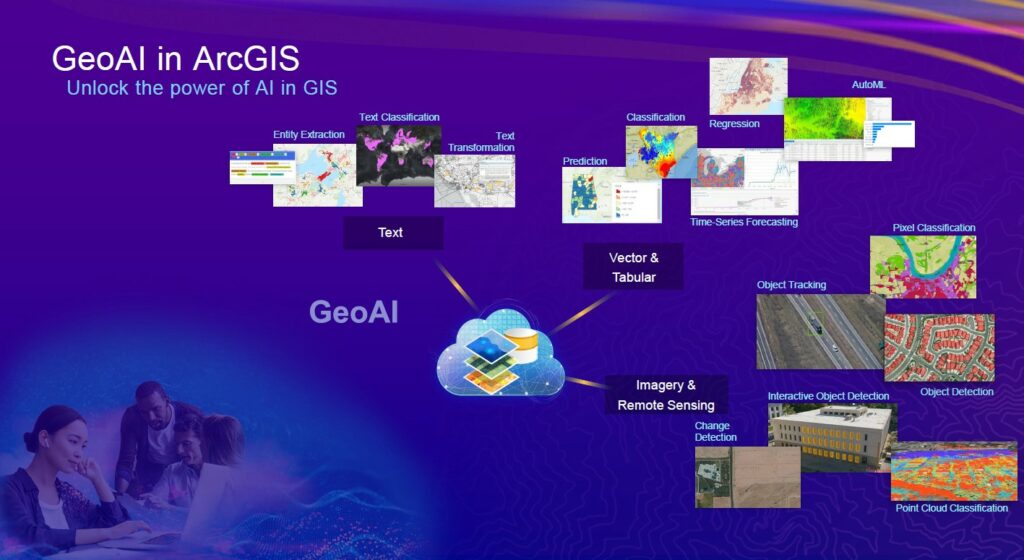
In a one-hour session entitled “GeoAI in ArcGIS” lead by Lauren Bennet and assisted by Nick Giner and Vinau Viswambharam, the group focused on the benefits of adding AI to the ESRI’s flagship product, ArcGIS. Bennet masterfully showed how AI is uniquely positioned to help organizations leverage the value of geographically located data for the benefit of the entire organization.
At the end of her presentation, she asked audience members to raise their hands if they were proud of a certain data analysis result that they had done in ArcGIS. Everyone raised a hand. Then she asked them: Do you consider yourselves data analysis scientists? Nobody raised a hand.
“You are all data analysis scientists,” Bennet said. “You have the technology and the tools to make incredibly valuable contributions to your organizations by adding AI-empowered geographical analysis to daily information technology operations.”
Then she solidified the point: “How many of you are in an organization that has a data science group that you are not part of?”
The audience remained silent, so she made her point “I challenge our community to increasingly see ourselves as the spatial data analysists that we are. We deserve to have a seat at the table, and we will not be invited. We need to be proactive and seek out that seat.”
After five decades of telling its customers and the world how GIS software was “special and different” from the usual software of IT departments, ESRI is now challenging ArcGIS users to join the IT world of AI. That this is being encouraged by the leading commercial GIS software company, is a very positive development and a good thing for both GIS and AI.
But why is this shift to IT happening now, and why has AI triggered it? The short answer is that the role of GIS in the IT world has been underway for a long time. A brief review of the origins of GIS and previous IT revolutions will help explain this and will set the table for future discussions on the topic.
The Beginning
Before GIS existed, there were just paper maps and tracing paper. GIS science and technology emerged more than 60 years ago at the same time as digital computing. GIS was invented and driven forward by an eclectic group of bright minds drawn from different disciplines, including pilots, surveyors, architects, geographers, cartographers, mathematicians, and yes, software developers.
 In the early 1960s, Dr. Roger Tomlinson dubbed as the “Father of GIS,” conceived of combining land-use mapping by means of emerging computer technology and initiated, planned, and directed the development of the Canada Geographic Information System (CGIS). This was the first computerized national scale GIS in the world.
Independently, Chicago architect Howard T. Fisher saw computer maps on urban planning and civil engineering graphics produced by Edgar Horwood’s group at the University of Washington. He conceived a computer mapping software program SYMAP (Synergistic Mapping) to produce conformant, proximal, and contour maps using a line printer.
With seed funding from the Ford Foundation that established the Harvard Laboratory for Computer Graphics, (the lab), Fisher and Betty Benson (the programmer), completed SYMAP for distribution in 1966. This was followed with other software programs developed by the lab, including SYMVU, GRID, CALFORM, and POLYVRT. Interestingly, the lab’s operational model was very similar to the way the open-source community of today works. It distributed software, and later data, at cost or free, to encourage academic experimentation and collaboration.
Jack Dangermond who, in 1969, founded the Environmental Systems and Research Institute (ESRI), worked as a research assistant at the lab in 1968 and 1969, the year he founded ESRI. In 1975, the lab initiated the Odyssey project with the aim to produce a vector-based GIS with spatial analysis capabilities within a single system. The key technologist of Odyssey, Scott Morehouse, joined ESRI in the early 80s to develop Arc/Info the software platform that became the leading industry GIS platform.
These early stages of GIS happened at a time when software development and computer platforms were in their infancy. There were no standard affordable hardware platforms. Storage of data was limited and expensive. The pixel resolution and color range of monitors were limited. There were no standard devices for capturing or printing and plotting maps, but there was a rapid explosion of new devices.
As a result, GIS developers had to spend a disproportionate amount of development effort to write code to use input and display peripherals. There was no standard way for computers to communicate with each other. The Internet only emerged in 1983. The Web browser source code for public use only became available in 1993.
When maps were on paper and data and programs were stored on punch cards and computer tapes, linking a digital vector map to attribute data was a novel concept. During this time ESRI was solidifying the concept of storing spatial (geographical) data in proprietary .SHP files (pronounced shape) and the related attribute data in .DBF files. The concept was solid and the advances in computer technology processing and storage capacity made the GIS idea feasible in the early 80s, creating an industry and turning ESRI into a privately held behemoth.
Unfortunately, the early innovation period was also a time of intense competition and an ill-advised commitment to proprietary data formats and hence the isolation of the newly created industry from itself and the larger IT world.
The RDBMS Database Revolution
In parallel to the GIS industry growth, the rest of the IT world was also evolving, but in exactly the opposite direction. The database science and software technologies were significantly improving particularly for enterprise IT-networked environments. Companies such as IBM and Oracle were successfully developing new relational models where the database’s schema and logical organization of the database could be separated from their physical information storage devices using communications networks.
 RDBMS became the science of storing everything, anywhere, and relational databases that could be analyzed using a generic SQL query and programming language became the norm.
This RDBMS approach opened the door to an explosion of applications that revolutionized the way the IT business worldwide has worked. Companies such as  SAP in Germany and IBM in the U.S. developed applications that allowed the enterprise to be more efficient, streamlining operations and enhancing productivity at levels that made these RDBMS systems indispensable and the bedrock of IT departments.
The IT-driven shift began. Every new application that was brought into the enterprise had to be based on RDBMS concepts in order to be approved by the strict parameters of the IT department, and therefore compatible with the rest of the organization.
However, RDBMS applications were also big and expensive and if adopted by GIS companies would require reengineering their entire platforms. ESRI’s was the market leader in GIS at the time their own and other proprietary GIS data formats were becoming a standard in different vertical markets. That unnegotiable difference isolated GIS implementations from the enterprise scale IT departments in organizations all over the world.
Initially this was not a major impediment to GIS growth. Most GIS users were spatial scientists, conducting boutique scale projects and not of concern to the mainstream of the IT departments. A brilliant strategy that more than compensated for the loss of IT department mindshare was the leadership role that ESRI adopted to promote the new science in colleges and universities.
Jack Dangermond championed R&D development in academia and donated ArcGIS software to many academic geography, geodesy, mapping, and land surveying institutions. This created several generations of professionals who graduated knowing only one way to do GIS, the ESRI way.
In the early 90s things changed and IT departments of large electric, water, gas, telecom companies, and municipal governments, which had to manage and grow large networks of physical assets over vast territories, were looking to add a geographical component to their operations. The leading GIS of the time were too proprietary and difficult to scale up to meet their needs. Doug Seaborne, the founder of GeoVision in Canada, developed and launched an enterprise GIS solution that was using an embedded Oracle RDBMS as the database engine.
This new GIS model, to store both geographic and attribute data in an SQL-accessible secure enterprise environment, was followed by other companies, including ESRI. Finally, an enterprise could associate their profitable and essential databases with a GIS, proving that the geographic component could be a valuable tool to increase the efficiencies of enterprise day-to-day operations.
The Web and Open GIS Standards
The explosive growth of the Web and the success of enterprise GIS in industry and government created a demand for the GIS industry to become more open and interoperable, based on well-defined open standards. Governmental agencies, industry, and academia inspired the formation of a non-profit organization called Open Geospatial Consortium (OGC). The OGC, founded in 1994, is an international voluntary consensus standards organization for geospatial content and location-based services, sensor Web and Internet of Things, GIS data processing and data sharing.
The web and open geospatial standards again changed everything. They fueled a new wave of end users, free web-based GIS applications, and databases that brought GIS to anyone in the world who had a PC or a mobile phone.
Google Maps, Google Earth, Street View provided once-unimaginable access to immense and accurate information for organizing, tagging everything, and finding and navigating to all the natural features and human infrastructure of our world. Everyone became a GIS user. The providers of these foundational tools started building massive Big Databases, rich with information to be mined for commercial and scientific benefit.
Now the Revolution
The year 2023 began with headlines exulting the potential benefits and threats of OpenAI and ChatGPT. We all are now able to interact and familiarize ourselves with AI applications using plain language with accessibility on our mobile phones. Every new generation of a new AI platform is more powerful than the previous one.
Having ESRI as an ally for the final integration of GIS into mainstream IT is key to the success of the endeavor. With hundreds of thousands of ArcGIS users all over the world preparing to empower and enable the geographical component into their respective IT organizations, the world will be a better managed place.
GIS data is uniquely designed to be analyzed and rendered in hundreds, if not thousands of different ways and AI will be a powerful ally in upcoming years to find new ways to do so. ν
Giulio Maffini started his career in the 70s as an urban and regional planner. Later he founded a company (TYDAC) to build Spatial Analysis PC desktop software (SPANS). In the early 90s he was part of team that commercialized an all-relational, multi user, Oracle-based enterprise GIS (VISION*) for Utilities, Telecom’s, and Municipalities. He is now an advisor to spatial technology companies. Juan B. Plaza is the CEO of Plaza Aerospace, a drone and general aviation consultant firm that specializes in modern uses for manned and unmanned aviation in the areas of mapping, lidar, and precision GNSS.