Tag Archives: gnss

Providing Comprehensive Geospatial Solutions
Sanborn is a full-service geospatial company that has been in continuous operation since 1866. Today, Sanborn is an innovator in the modern geospatial industry, delivering state-of-the-art mapping, visualization, and 3D solutions for customers worldwide. Sanborn offers comprehensive geographic information solutions to city, county, regional, state, and federal government agencies, private companies, and international clients. Our...

xyHt Weekly News Recap: 04/29/2022
NSPS Joins Coalition Effort to Raise Concerns on GPS Interference with President Biden and Congress Association for Geographic Information Celebrates Return to In Person Events White House Wants to Counter the Use of Drones in the U.S. USGIF Announces New Scholarships and a New Working Group Focused on Diversity, Inclusion, and Belonging Auterion Delivers New...

Trust Your Position with Applanix
For nearly 30 years, Applanix, A Trimble company, has offered complete and customized mobile mapping solutions while championing the technology revolution that allows pinpoint positioning in any condition. Applanix is the standard for organizations that depend on accuracy and quality, and value experienced partners. Our turnkey and OEM GNSS-Inertial solutions are designed for pinpoint accuracy,...

When a Drone Just Can’t Do It
There is a growing ebb in the tide of UAS adoption for aerial surveying, mapping, and remote sensing—finding the right balance between manned and unmanned aerial operations Unmanned aircraft systems (UAS), remotely piloted aircraft systems (RPAS), or just plain old “drones”—call them whatever you wish—have had a tremendous impact on geospatial industries. A decade ago,...

Capturing Today’s (and Tomorrow’s) Constellations
Access to all GNSS constellations provides better data, better results Enhancements made to improve the handling of satellite systems (also called constellations) and the increasing number of signals produced by these systems provide a tangible benefit to any solution that requires precise positioning. Depending on the time of day and the geographical location, some of...
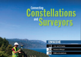
xyHt Digital Magazine: April 2022
Like a good surveyor, xyHt‘s March issue covers a lot of ground, bringing you stories about surveying, mapping, UAVs and, this month’s special, a look at how drones are becoming indispensable on construction sites. As always, if you don’t have a subscription to our print edition, or if someone else in the office has snaffled your...