Tag Archives: maps as art

Esri UK Conference 2019 Recap
Every year towards the end of May, Esri UK, the UK distributer for Esri software, holds a user conference across the road from Westminster, the home of the UK parliament (when I was there I even got to see Jacob Reese Mogg). It’s held at the QE2 centre, and there are amazing views from the fifth floor which allow...
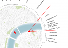
What’s within a 30-minute Walk – Revisited
I recently had reason to be in London for a short meeting and walked past London Bridge, looked at the sky around me, and thought, “I wonder how accurate that map I made last year is?” I was fortunate to have my camera phone with me so that I could take a few pictures. The...
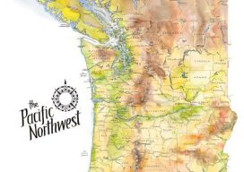
The Pacific Northwest
Maps as Art These earth-toned watercolors reflect the greens, browns, yellows, and blues of the verdant Pacific Northwest. I spent hours comparing source material and drawing and re-drawing this map, so I have a new depth of admiration for the mapmakers of old who pioneered this exacting business. I begin every map with a 1″...