Tag Archives: SenseFly

xyHt Weekly News Links: 9/22/17
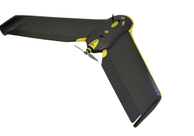
Phase One Industrial Introduces 190MP Aerial System Orbit GT to showcase new v18 for Mobile, UAS, Indoor and Aerial Mapping at Intergeo, Berlin Hosting massive geodata made easier by new cloud solution LizardTech Awarded U.S. Patent for LiDAR Point Cloud Compression senseFly to launch industry-specific solutions at INTERGEO 2017 Measure’s First Drone Services Franchise Opens...
UAVs Planting Trees
… And What That Means for Next-gen Drones Honestly, I don’t pay much attention to unusual uses of UAVs; I focus on geospatial applications. However, after reading the news about a company using UAVs to plant trees, perhaps I should. Let’s take a look at the story and see what it could mean for the...

Don’t Buy a Drone
Instead, invest in a fleet of drones. (Apologies for the clickbait headline!) While I was talking to a surveyor whose firm employs UAS in their work, he mentioned the different models of the craft they have. I interrupted him: “Just how many drones do you have?” “16” was the answer. This got me thinking about...
xyHt Weekly News Recap: 7/7/17
Tersus launches a ‘new generation’ NeoRTK system senseFly announces worry-free service package to keep professional drone operators flying Surveying the World of Tomorrow CompassCom to Release CompassTracker App for iOS & Windows Mobile Smart Phones at Esri User Conference Trimble Catalyst high-accuracy, on-demand geolocation service now available worldwide Quorum Launches myQuorum Land On Demand, Bringing Speed...

Mapping Rwanda: Surges Forward in UAS Mapping Use
From cadastral to precision agriculture to humanitarian aid, UAS are making a big difference while mapping Rwanda. (Above: Course participants examine an orthomosaic in Pix4Dmapper during software training.) After Rwanda made waves in the news early last year for allegedly being the first country to approve drone delivery, people payed attention. The country, with its rolling...
xyHt Weekly News Recap: 5/19/17
Satlab Geosolutions introduces Ultra-Compact Multiconstellation GNSS UAV/RTK Receiver including Dual Antenna Heading capability senseFly Corridor solution boosts efficiency of linear mapping projects Icaros Releases Version 5.0 of OneButton™ Drone Image Processing Software Congress increases funding for UAS research, airspace integration Blue Marble Releases Mobile Friendly Version of the GeoCalc Geodetic Registry Swift, Carnegie release Duro for...