Tag Archives: UAVs

xyHt Weekly News Recap: 09/15/2023
Cadcorp Supports Customers in Gaining Deeper Insight from Data Aaron Addison Takes Over as Executive Director of WGIC Commercial UAV Expo 2023 Reports Largest Exhibit Hall and Attendee Growth ASPRS Approves Edition 2 of the ASPRS Positional Accuracy Standards Register for Trimble Dimensions NSPS Certified Sessions China Finishing High-precision Ground-based Timing System EuroGeographics Calls for...

xyHt Digital Magazine: May 2023
xyHt’s May issue focuses on uncrewed aerial vehicles and uncrewed aerial systems. As is the case with almost every aspect of the geospatial professions, UAVs and UASs are constantly evolving with advances in technology. As always, if you don’t have a subscription to our print edition, or if someone else in the office has snaffled your...

2022 and the Promise of Expanded UAV Operations
What needs to happen over the next 12 months for the promise of flights beyond visual line of sight (BVLOS) to become a reality? Well, actually, quite a lot. The Federal Aviation Administration (FAA) needs to relax the rules for unmanned aviation and the industry needs to prove that current technology, such as detect and...
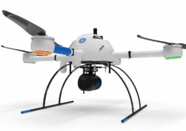
Autonomy Comes to UAVs
Trending tech has UAV software looking futuristic To a certain degree, autonomous operations are already baked into the current state of data collection (aka reality capture) software for UAVs. Pre-mission planning consists of using a map-based interface to highlight the area that needs to be mapped or inspected, the appropriate flight pattern and height (AGL)...

xyHt Magazine Digital Edition: September 2021
xyHt's September issue includes features on UAVs, deep learning, oceanography and adventure.

Build, Buy, Rent, or Hire?
Seven years ago I was invited to attend a UAS flight course; this was an exciting proposition as the drone craze was not yet under way. In fact, the rules for operating drones in the U.S. were so in flux (as far as commercial and private drone use) that the course had to be held...