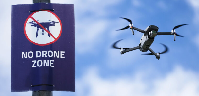
What needs to happen over the next 12 months for the promise of flights beyond visual line of sight (BVLOS) to become a reality? Well, actually, quite a lot. The Federal Aviation Administration (FAA) needs to relax the rules for unmanned aviation and the industry needs to prove that current technology, such as detect and avoid (DAA) and unmanned traffic management (UTM) is scalable and ready for prime time.
In October 2021, FAA administrator Steve Dickson addressed a packed auditorium at the Commercial UAV Expo in Las Vegas and directly spoke to the needs of the industry in general and BVLOS in particular.
“In June, the FAA created the aviation rulemaking committee or ARC by selecting 90 members, and they started work immediately. They’re looking closely at the safety, security, environmental, and other policy needs, as well as societal benefits of these operations.” Dickson said.
The ARC committee’s recommendations would result in more predictability for drone manufacturers and operators. That, in turn, would pave the way for routine package delivery, infrastructure inspection, and other more complex drone operations beyond visual line of sight of the remote pilot.
ARC’s recommendations were expected late last year, but regardless of whether that timeframe became a reality, the fact remains that the FAA is committed to propel non-traditional aviation to mainstream status in the near future, while maintaining the impeccable safety record of commercial manned aviation. Now the question is what needs to happen in order for 2022 to be any different than 2021 or 2020?
These decisions by the FAA in the USA and the European Air Safety Agency (EASA) in Europe are important for surveyors and photogrammetrists alike for one reason: the difference between manned and unmanned mapping today is a matter of scale. Not map scale, but land size scale. In other words, today traditional cartography with large, manned aircraft can cover any mapping job, regardless of location or size, the same way it has been done for decades. Unmanned aviation photogrammetry is still relegated to small jobs, preferably in remote locations and flying low, ideally below 400 feet.
New and improved UAVs can now fly for hours and cover large amounts of land in just a few hours of flight at a fraction of the cost of traditional methods, but BVLOS restrictions and altitude limitations, will continue to be a hindrance to the full development of unmanned cartography until these regulating agencies change their rules regarding unmanned aviation. Companies like Parallel Flight Technologies of La Selva, and Skyfront of Menlo Park, both in California, are developing platforms with over four hours of flight with loads that allow for multiple sensors as well as safety considerations.
There are many obstacles to the full integration of manned and unmanned aircraft in controlled airspace but the key issue that we need to address is that replacing the pilot would necessarily require a lot of new and untested technology, such as unmanned traffic management (UTM), detect and avoid (DAA) and a serious alternative to the use of current air traffic control (ATC).
Unmanned Traffic Management
In the past few years many companies, established and startups alike, have realized that without an independent unmanned traffic management system, the integration of traditional manned aviation and new non-traditional unmanned aircraft is going nowhere. Many versions have been developed and an incredible number of tests have been conducted trying to develop a system that would handle hundreds if not thousands of autonomous flights without the direct intervention of air traffic controllers.
Some of these UTM systems have been deployed in test mode around the world with great success, but, unfortunately, these instances had a limited number of aircraft under monitoring and the reality of scalability to thousands of potential targets in real life scenarios is still unproven, at least to the regulator’s satisfaction. Systems from Airmap (www.airmap.com), Altitude Angel (www.altitudeangel.com) and countless others, are being used daily to manage certain fleets, but their level of safety and reliability is not yet recognized by the FAA and EASA to be sufficient to grant full integration with manned aviation.
But are the systems ready? In opinion of many the answer is yes. But regulators are requiring more tests and more scalability tryouts to allow full integration.
Detect and Avoid
Detect and avoid is another key component of the integration puzzle that needs to be resolved in parallel with UTM in order to convince regulators around the world that mixing manned and unmanned aircraft in controlled airspace would guarantee that current safety level would be maintained. DAA is simply a technological way to replace one of the key functions of a pilot, to see outside the windshield and look for other aircraft that might be a hazard to the flight.
In here we must enter the domain of manned aviation to explain the differences between the two basic flying rules: visual (VFR) and instrument (IFR). Most, if not all, commercial flights in the USA are conducted under IFR and pilots are directed to evade traffic by following instructions from air traffic control, not by looking outside their windshield. Pilots on IFR flights only look outside to confirm to ATC that they have traffic in sight when requested to do so.
On the other hand, general aviation flights are mostly conducted under VFR and pilots are responsible to maintain visual separation with traffic at all times without guidance from ATC. These flights are most commonly local flights of small propeller aircraft flying under 15,000 feet.
All drone and UAM flights will have to be conducted under IFR given the fact that there is no pilot on board, even though it is generally accepted that the first air taxis will have a pilot to assure a smooth transition to pilotless flights in the future.
These unmanned flights will have to have a system onboard that would allow the aircraft to determine if there is a hazard to the flight on a pre-determined flightpath. In other words, the pilot’s function that ensures visual separation with other objects will have to be automated and the algorithms will have to deal with moving as well as fixed objects.
It is generally accepted that these algorithms will contain a lot of artificial intelligence (AI) and that the system will learn and improve as it is used. In case of an encounter with obstacles in the flightpath there will be alternatives for deviation, within certain parameters, emergency landing/continuation of the flight or outright termination of the flight. In any case, DAA will have to be ubiquitous in every autonomous drone to ensure safety.
Air Traffic Control
The last, but not least piece of the unmanned, autonomous universe is the relationship with existing air traffic control. Even though it is universally accepted that ATC in its current form will not take care of anything related to unmanned aviation, it is also understood that air traffic controllers will have to have access to all those flights happening in or under their monitored airspace.
For a system that was developed in the 1950s and is based on radar, VOR-defined (VHF Omnidirectional Range) airways and voice controls, the safety record is incredible. Commercial airliners in the USA have not have a fatal accident in 12 years with over 10 billion people flown safety from point A to Point B and all connected to each other and to the ground using radio commands and ground technology that is over half a century old. Not too bad.
But, in the near future this system will be tested to its core, by the addition of thousands of unmanned vehicles making deliveries of cargo and passengers in a revolutionary new way of doing things. ATC will have to have access to these flights if need be, but there will be no direct communication or control over these flights except in case of an emergency, when it is presumed that the new system will have safety protocols to land a drone/air taxi if it enters in conflict with a passenger plane.
All of these new systems will have to be in place and fully tested before we can enter an era of full integration of manned and unmanned aircraft in controlled airspace, so the question is, would that happen in 2022?
The answer is sadly, no. We are not there yet in terms of demonstrating to the FAA or EASA that these vehicles are 100 percent safe and the systems being developed to make them so are infallible. But the good news is that every year we make immense advances in terms of technology and understanding of the interaction between manned and unmanned aviation, and the FAA’s Dickson is championing this cause.
So, what would a likely timeframe be? If I had to make a prediction, I would say that by 2025 we will have the first unmanned flights in controlled airspace as a matter of routine and that would open the door for surveyors and photogrammetrists to enter a new ear where larger and larger areas can be covered, safely and inexpensively. The era of real competition between drone mapping and aircraft mapping will be here to stay.