All posts by Jackie VanderPol
Protecting Urban History
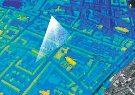
Maximizing the data collected from airborne lidar helps protect historic structures in older cities In Part I last month, we outlined the research performed in Dublin, Ireland, and Brooklyn, N.Y., using hyperspectral scanning to help old cities protect historically significant buildings during new construction projects. In Part II, NYU professor, Dr. Debra Laefer, explains how...

Protecting Urban History
Researchers demonstrate how lidar, combined with imagery and hyperspectral data, helps prevent costly damage to historic buildings in urban construction zones. With every new underground urban rail or roadway tunnel, deep foundation shaft for a new building, or even simple streetscape upgrade, historically significant architecture in older city centers can become vulnerable. Earth displacement from...

Geospatial Adventure: Ghost Towns and Diamond Mine Memories
Diamond mine memories: A century or so ago, miners in the small settlement of Pomona pulled 50,000 carats of diamonds a month from the vast, arid nothingness of land called the Sperrgebiet—10,000 square miles of coastal desert in southwestern Namibia in Africa. The sandy ground has long since given up the last of its precious...