All posts by Nick Bearman

Supporting Free and Open-Source Software
Free and open-source software (FOSS) is sweeping across the IT industry, everywhere from office programs (LibreOffice) to GIS software (QGIS, R, Python). It is also being used extensively by large companies such as Microsoft, IBM, Amazon, and Netflix for their internal services as well as being used as building blocks to offer services to clients. ...

General Data Protection Regulation and the Locus Charter
Helping geospatial professionals to work ethically with location data Responsible data use is key to many professionals, not just in the geo and location industries. Data and privacy has been on our radar for a number of years now, and in recent years it has come to the forefront with the advent of General Data...
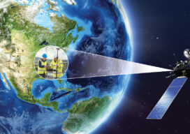
A Better GNSS?
With America, Russia, China, and the EU all now having GNSS constellations operating, what does it mean for surveyors and geospatial professionals?
PDR and the Pandemic
What continuing education will look like in the post-Covid-19 world Our Professional Development Record (PDR) hours—CPD in the UK—are a key part of the surveying and geospatial professions. Previously PDR would have involved a mixture of in-person training, in-person conferences and self-study training materials. With the Covid-19 restrictions on meeting other people face-to-face, meetings are...
Using QGIS in the Cloud with Amazon Web Services (AWS)
It’s easy to run a popular open-source geospatial suite on this hosted cloud platform: AWS. QGIS is a great piece of software, and I would really recommend you try it out if you are currently working with ArcGIS, MapInfo or any other piece of GIS software. However, if you don’t have admin rights on your...
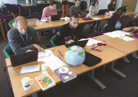
Let’s Be Colleagues: New Settings for GIS Mentoring
Mentoring is a key aspect in any career; otherwise how do we learn what we need to do and how we need to work in a particular environment? Mentoring is even more important for an SME (small- to medium-sized enterprise) or freelancer. Working on your own is increasingly common in the geospatial field, with the...