All posts by xyHt

Weekly xyHt News Links: 02/15/2019
Trimble Launches Division Dedicated to Advancing Commercial Map-Centric Technology International LiDAR Mapping Forum Draws 1,682 Professionals for Education, Networking, and Geospatial Technology NavVis now uses SLAM to automatically remove point cloud artifacts UgCS introduces Telemetry Sync tool for DroneLogbook MAPPS Presents the 2018 Geospatial Products and Services Excellence Awards SimActive Expands its Partner Network for...
Weekly xyHt News Links: 02/08/2019
Sokkia introduces integrated receiver for diverse applications NGS to perform another Multi-Year CORS Solution Delair launches delair.ai, industry’s most powerful aerial intelligence platform, to unlock the value of drone data collection for enterprises Teledyne Gavia Introduces SeaRaptorTM 6000m AUV at Ocean Business INTERGEO Post Show Report 2018
Weekly xyHt News Links: 02/01/2019
CompassDrone, Newest Division Of CompassData, Integrates UAV LiDAR Solutions RIEGL announces expansion of their global presence in Australia and Oceania: New RIEGL office in Australia opened! Sokkia introduces integrated receiver for diverse applications CompassData’s Celebrating 25 Years Dedicated To Excellence in GeoSpatial Technology FLIR Systems Acquires Aeryon Labs for $200M
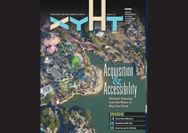
xyHt Magazine February 2019 Issue
Click on the cover below to view the February 2019 issue of xyHt magazine. Articles in the issue include (links will turn live throughout February): Aerial Self-sufficiency – A large risk-assessment and data-analytics company created its own internal system to collect imagery, write software, and develop processing workflows. Sydney’s Paleovalley in 3D – Tunneling under Sydney Harbour for...
Weekly xyHt News Links: 01/25/2019
LiDAR and drones: learning to use the powerful combo Virtual Surveyor 6.2 Now Processes Larger Drone Survey Projects Exact Metrology Preserves History with Scanned Replica of Statue Topcon announces upgrade to MAGNET Collage Web complete with new deliverable options International LiDAR Mapping Forum January 28 – 30, 2019 Topcon announces advanced concrete application workflows Unique...
Weekly xyHt News Links: 1/18/2019
Multivista Announces DroneDeploy Partnership, Advanced UAV Mapping Services EdgeTech Delivers Innovative Solution for Deep Water Acoustic Release Mooring Recovery FIG Commissions and Their Work Plans 2019-2022 Esri Relaunches ArcGIS For Developers HistoryMiama Museum to Host the Longest Running and Largest Map Fair in the Americas CHC Navigation introduces the APACHE 3 portable USV Solution....