
Blog

Weekly xyHt News Links: 08/02/2019
Velodyne Lidar Acquires Mapper.ai for ADAS Launch

Walkaround Mobile Scanning Part 1
Above: Walkaround mobile scanning is being increasingly used as a go-to tool for as-built surveys of residential properties as an input to remodel design. Credit: Precision Property Measurements. Part 1: Basic types, differences, and advantages. Walkaround mobile scanning includes “backpack,” “push-cart,” “hand-carry,” and “handheld,” but whatever you call it, it’s gaining real momentum in the...
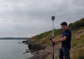
Survey-grade PPP
Above: Using a real-time PPP-capable GNSS rover on the Wicklow coast of Ireland. Credit: Niall Hand, Korec Group. Has real-time precise point positioning finally hit prime time for surveying applications? The answer is a qualified yes. The dream of being able to achieve survey-grade (2cm horizontal and 5cm vertical) GNSS-derived positions without post-processing, a base,...

xyHt Magazine August 2019 Issue
Click on the cover below to view the August 2019 issue of xyHt magazine. Articles in the issue include (links will turn live throughout August): Seen at HxGN LIVE 2019– xyHt staff share what we saw at HxGN LIVE 2019 Survey Grade PPP – Has real-time precise point positioning finally hit prime time for surveying applications? The...
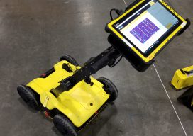
Seen at HxGN LIVE 2019
BLK2GO SLAM (simultaneous localization and mapping) lidar handhelds have become popular for BIM, as-builts, and rapid 3D modeling. The new Leica Geosystems BLK2GO shares some of the core technologies of earlier members of the BLK family (like the BLK360 scanner). What distinguishes this from many of the other SLAM handhelds is that it utilizes cameras...
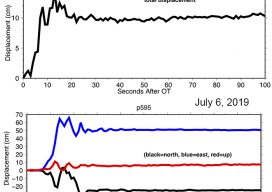
Shake, Rattle & Roll: Disruptions to the Geodetic Fabric
On July 4, 2019 the desert region near Ridegcrest, California was hit with a magnitude 6.4 earthquake, resulting in minor damage in the area, most significantly to the infrastructure at the Naval Air Weapons Station at China Lake. Approximately 44 hours later on July 6th, a larger earthquake of magnitude 7.1 struck the region, causing...
Advertisement