
Blog

Weekly xyHt News Links: 07/19/2019
SOLV3D Announces New Product Branding and the Addition of a Widget for Esri ArcGIS Enterprise™ Trimble 4D Control Software Delivers Streamlined Real-Time Monitoring System Deployment and Simplified Geotechnical Sensor Support FAA Establishes New Restrictions on Drone Operations LidarUSA Introduces Long-endurance Multicopter Lidar Solution Septentrio strengthens its GNSS/INS portfolio with a single antenna receiver GIS for...

Search for the Missing Pier
Above: The Gaithersburg Latitude Observatory is now a community park. My tale of locating the latitude pier of the Cincinnati Latitude Observatory, one of six international latitude observatories now defunct but historically significant. It was 1974, and I’d been working at the National Geodetic Survey (NGS) for two years. One afternoon my boss told me...

Piping Hot Tech
Above: The cramped field conditions in the underground tunnels are evident in this point cloud Trammel used to create the 3D tunnel piping. From crowded boiler rooms to hard-to-reach underground tunnels, BIM experts tell us how following a smooth workflow is key to rapidly creating accurate 3D pipe models from point clouds. Inside the Student...

Help Shape the Future of Surveying – SaGES 2019
Your input is requested. Surveying professionals and practitioners are invited to weigh in on matters of surveying and geomatics education, succession planning, branding, promotion, and outreach. The 27th national biennial meeting of the Surveying and Geomatics Educators Society (SaGES) will be held August 4th – August 8th, 2019 at Nicholls State University, in Thibodaux, Louisiana (near...
Weekly xyHt News Links: 07/12/2019
Review Rugged Tablet with 3D Imaging and GNSS for Realtime Mapping Microdrones to showcase their Integrated Systems on the West Coast during their California Summer Tour New Usage-Based Service Plans for Trimble Catalyst Enable Geospatial Organizations to Access Precise Positioning On Demand LIDARUSA ANNOUNCES LONG ENDURANCE MULTICOPTER LIDAR SOLUTION Virtual Surveyor Enhances LiDAR Point Cloud...
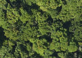
Many Sensors for a Tulip Tree Map
Above: The forests of Puerto Rico are second-growth, making for useful modeling. After hurricane deforestation in Puerto Rico, NASA scientists study forest regrowth using high-resolution, multi-sensor image data. The Biospheric Laboratory of the NASA Goddard Space Flight Center is dedicated to increasing knowledge about the Earth’s terrestrial ecosystem. One group of scientists there has been...
Advertisement