
Blog

Smart Cartography
Six examples of how old-fashioned navigation aids have been transformed into today’s smart maps Berlin, Germany 25, April 2017 | The 65th Cartography Conference run by the German Society for Cartography (DGfK) in 2017 is dedicated to smart cartography. At INTERGEO 2017, the community is showcasing its credentials as an innovative scientific discipline that excels...
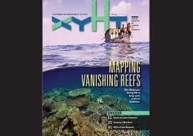
xyHt Magazine June 2017 Issue
Click here to view the June 2017 issue of xyHt magazine.

Point A to Point BIM
Our publication is all about how to get from (or measure between) point A to point B: the processes, tools, software, methods, and professional spatial judgments that go into these actions. Sometimes the road between A and B has a lot of twists and turns, and in the case of moving design and construction from...

GEO Business 2017
Nicholas makes the annual pilgrimage to GEO Business for xyHt This blog is going to start with a short piece about skips. If you are afraid of skips (skips are what you’d call “dumpsters” across the Atlantic), turn away now …. Monday morning and 24 hrs from the start of GEO Business 2017, I get...

xyHt News Links: 5/26/17
Echodyne announced a $29M Series B round to scale its technology for drones, autonomous vehicles, on-the-ground detection and more. New Long Endurance UAV Introduction – the Scout B-330 UAV from Aeroscout Esri Releases EMU Mobile App for Understanding of the Ocean Anywhere, Anytime Gexcel Presents Wearable Mobile Surveying System Descartes Labs to Unveil Cloud-Based Geospatial Analytics Platform at...
Peer Review: Professional Standards in the Surveyor’s Field
Let’s rethink how we license the land surveyor. By Daniel R. Muth, PLS, CFedS I had the benefit of starting my surveying career at a very early age. It began when my father, a licensed land surveyor, needed cheap labor. Being his son, I was readily available whenever and wherever...
Advertisement