
Blog

The Power of Tethered Drones
Before the FAA’s Rule 107 allowing UAS use for commercial work, we waited patiently (and often impatiently) for the day when UAS would be “unleashed.” Ironically, now a new class of UAS gets its power from actually being on a leash. Tethered drones use a hardware tether (as thin as a headphone cord) from the...

xyHt Weekly News Recap: 5/19/17
Satlab Geosolutions introduces Ultra-Compact Multiconstellation GNSS UAV/RTK Receiver including Dual Antenna Heading capability senseFly Corridor solution boosts efficiency of linear mapping projects Icaros Releases Version 5.0 of OneButton™ Drone Image Processing Software Congress increases funding for UAS research, airspace integration Blue Marble Releases Mobile Friendly Version of the GeoCalc Geodetic Registry Swift, Carnegie release Duro for...

GeoDude: The Adoption Status of Laser Scanning Today, Part 1
By Geoffrey Jacobs Note from the editor in chief: In 2006 when I began at this magazine’s predecessor, Professional Surveyor, Geoff Jacobs was already an established 3D scanning columnist, trusted as an industry specialist and read regularly by our subscribers. He’s a significant leader in the field; Geoff is also a pleasure to work with....

GEO Business 2017 – Exhibition Preview
Next week, from May 23-24, GEO Business, the UK’s biggest geospatial exhibition and conference of the year, returns to the Business Design Centre in London. Over 3,000 visitors, from 67 countries, will be there to discover the latest new products, services and solutions from 200 leading industry innovators. Attendees will also have chance to meet...
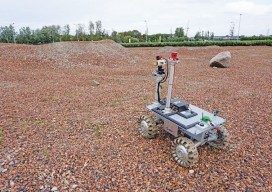
Robots for ExoMars: Drones and Space Exploration
Drones are being used to test a space rover in familiar ways. By Martin Azkarate UAV manufacturer senseFly talked to Martin Azkarate of the European Space Agency about his work developing rover prototypes for planetary exploration, including how he employs a senseFly drone to test these cutting-edge robots. Martin is a space automation and robotics...
xyHt Weekly News Recap: 5/12/17
MKS’ Ophir® Business Unit Introduces Smallest, Lightest Weight, Continuous Zoom Lens for Drones & UAVs Swift Navigation and Carnegie Robotics Announce Duro, a Ruggedized Version of Piksi Multi Announcing UgCS Mapper – in-field mapping software requiring no internet connection Septentrio launches AsteRx-m2 OEM GNSS Receiver Alta Devices Adds Solar Tech to Drones/UAV’s to Extend Flight...
Advertisement