
Blog

Autodesk University, Star Trek Nostalgia, and a Little Bit of Latin
(A press release from Autodesk.) Autodesk University offers glimpse at the very-near future of AEC Today’s Autodesk University keynote focused on product innovation and offered a glimpse at the not-so-distant future of making things in the architecture, engineering, and construction (AEC) industry. Sarah Hodges, director, Autodesk Construction Business Line, revealed these top news items to...
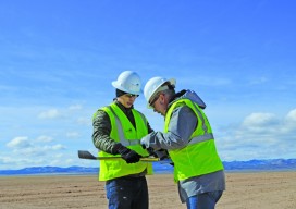
UAS: Measuring for Solar
Above: The Mortenson team prepares their senseFly drone for flight. With a UAS, a construction firm finds value—in addition to what can be measured—in real-time assessment and data availability. Surveying plays a crucial role in construction, from initial planning to final as-built verification, often in multiple phases. However, terrestrial survey methods come with challenges for...
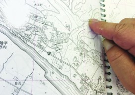
Cross-Pacific Ties and A Disturbed Monument
Above: The surveyor who set the original stake in Hyu-ga, Japan shows the spot in the Zenrin map book of the Miyazaki Prefecture. Located 28,280,841 feet +/- from original location. Editorуs note: A chance discovery by an Oregon beachcomber has forged cross-Pacific ties between two coastal cities–and their respective surveying communities. A few months ago,...

Autodesk University: BIM Preview
Autodesk Previews How “Connected BIM” Will Shape the Future of Work in the AEC Industry From the Autodesk press release: AEC professionals attending Autodesk University to experience the next evolution of BIM At this year’s Autodesk University, one thing will be abundantly clear – Building Information Modeling (BIM) is the nexus of designing, building, and...

xyHt News Links: 11/11/16
Trimble Software GNSS Receiver Provides High-Accuracy, On-Demand Positioning-as- a-Service Lead’Air Creates an Unparalleled Multi-use “HELIDAS” Oblique Camera System for Helicopter and Fixed-wing Aircraft Caterpillar and Trimble to Expand Mining Technology Collaboration Microdrones™ partners with Delair-Tech to offer complete aerial mapping toolkit Trimble Business Center Software Adds Scanning Module, Support for Complete Third-Party Data Integration and...
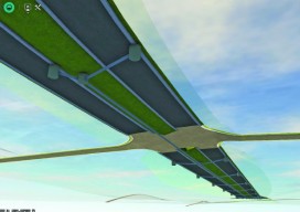
3D Software, Not Really Like CAD at All
Above: InfraWorks 360 uses engineering rules to ensure that vertical and horizontal curves in infrastructure elements have the proper radii. Take a close look at Autodesk’s InfraWork’s 360, an unusual 3D modeling software. Editor’s note: For many firms and practitioners of surveying, photogrammetry, mapping, and remote sensing, traditional deliverables to AEC clients have focused on...
Advertisement