
Blog
Coordinates: The Rodney Dangerfield of Boundary Surveying
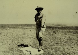
Although my entire surveying career has been in California, I believe that the following is true in almost every, if not every, state. With regards to the Priority of Evidence Rules (Rule of Construction), when conflicting elements exist when determining boundary location, coordinates are always at the bottom of the list. In my 30 years...

The Green Monsters of GPavin
An interview with the director of the GPS Directorate Col. Steven P. Whitney recently answered questions about the mission of the directorate, and he debunked a popular myth about the GPS constellation. Colonel Steven Whitney is the director of the Global Positioning Systems (GPS) Directorate at the Space and Missile Systems Center, Air Force Space...

Carlson’s BRx5 Receiver: the Birth of a New Instrument
Carlson Software & Hemisphere GNSS Bring a Lightweight Receiver to Market For land surveyors and others in careers that rely on constant use of GPS and GNSS technology, not to mention the millions of consumers with receivers in their smart phones, it is easy to forget that instant location remains technologically miraculous, relying as it...
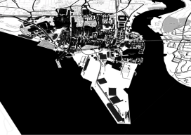
Map Making: “Can I have a map?”
“Can I have a map?” How often do you get someone ask, “Can I have a map”? I have nothing against making maps; in fact I like it so much that I have made a career out of it. Not just any map either, I’ve made maps for the nuclear, environmental, government, renewable energy, offshore...

xyHt News Links: 10/7/16
GeoSLAM (handheld laser scanning) and Blackdog Robotics (unmanned robotic vehicles)partner for remote surveying in hazardous environments/uneven terrain TerrAvion Launches First Aerial Imaging Solution Specifically Designed for Rangeland Trimble Changes Name to Reflect Company’s Technology Evolution Teledyne Optech to introduce new static and mobile surveying solutions at INTERGEO 2016 senseFly to Unveil new RTK/PPK-Ready, Large Coverage Mapping Drone at INTERGEO 2016...
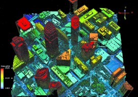
A Lidar That Oversamples: Geiger Lidar Imaging
Harris Corporation’s Geiger-mode lidar reaches new markets. Typical linear lidar systems repeatedly fire a single beam, each time measuring a single location on the ground. They collect data at a given resolution, which is also the processing resolution. By contrast, a Geiger-mode system is an array that illuminates a large area on the ground, capturing...
Advertisement