Category Archives: Aerial/UAS
Mapping Rwanda: Surges Forward in UAS Mapping Use
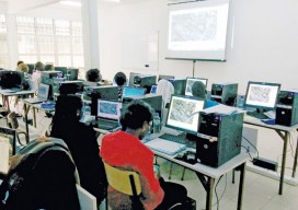
From cadastral to precision agriculture to humanitarian aid, UAS are making a big difference while mapping Rwanda. (Above: Course participants examine an orthomosaic in Pix4Dmapper during software training.) After Rwanda made waves in the news early last year for allegedly being the first country to approve drone delivery, people payed attention. The country, with its rolling...
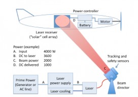
Laser-powered UAS
As noted in our latest issue about tethered drones, the ability to power UAS from the ground exponentially increases flight times and allows the use of heavier sensor payloads. Tethering accomplishes this at the cost of range, however: generally 200-400’ with commercially available tethering systems. What if a system had the advantages of tethering and...

Launch of INTERGEO 2017: Topics that get the geo-IT sector noticed
Berlin, 16 May 2017 3, 2, 1 and lift-off. The 2017 INTERGEO season is underway, with a programme fully reflecting its long-standing key focus – “Knowledge and action for planet Earth”. Once again in 2017, the leading international trade fair for geodesy, geoinformation and land management’s hot topics will highlight ground-breaking developments and projects of...

GEO Business 2017
Nicholas makes the annual pilgrimage to GEO Business for xyHt This blog is going to start with a short piece about skips. If you are afraid of skips (skips are what you’d call “dumpsters” across the Atlantic), turn away now …. Monday morning and 24 hrs from the start of GEO Business 2017, I get...
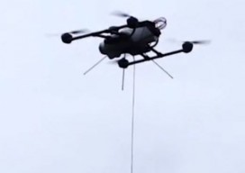
The Power of Tethered Drones
Before the FAA’s Rule 107 allowing UAS use for commercial work, we waited patiently (and often impatiently) for the day when UAS would be “unleashed.” Ironically, now a new class of UAS gets its power from actually being on a leash. Tethered drones use a hardware tether (as thin as a headphone cord) from the...
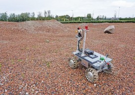
Robots for ExoMars: Drones and Space Exploration
Drones are being used to test a space rover in familiar ways. By Martin Azkarate UAV manufacturer senseFly talked to Martin Azkarate of the European Space Agency about his work developing rover prototypes for planetary exploration, including how he employs a senseFly drone to test these cutting-edge robots. Martin is a space automation and robotics...