Category Archives: Aerial/UAS

Mainstreaming Augmented Reality: No Headset Required, Part 1
Augmented reality technology is rapidly evolving into the mainstream; now you can employ and enjoy AR on your smartphone. Let’s start with Apple’s ARKit, a software developers’ kit (SDK) for augmented reality. Apps developed on this platform will work with all iPhones and iPads that use the A9 or A10 processor and are running iOS...
UAVs Planting Trees
… And What That Means for Next-gen Drones Honestly, I don’t pay much attention to unusual uses of UAVs; I focus on geospatial applications. However, after reading the news about a company using UAVs to plant trees, perhaps I should. Let’s take a look at the story and see what it could mean for the...
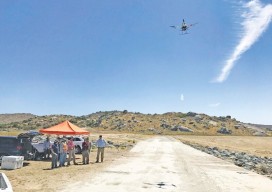
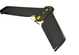
Drones & Surveying Flood Zones
In Juniper Flats, CA, county land surveyors use UAS to save tax dollars and project times and to improve public safety. Photo above: Steven Lewis, Trish Ortega, Paul Clements, Claudio Padres of RCFC & WCD; Sebastien Borghini of Microdrones; Dan McMahon of Allen Instruments. Joshua Tremba does a lot of mapping; he’s the supervising land surveyor...
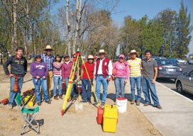
Photogrammetric Engineering at The National Polytechnic Institute
A profile of their surveying and photogrammetric engineering program Featured image: IPN students doing field work for a class at the National Autonomous University of Mexico in February, 2012. Credit: Roberto Garcia. The Superior School of Engineering and Architecture, Ticomán Unit, is located in the north of Mexico City, Mexico, and offers a degree in surveying...
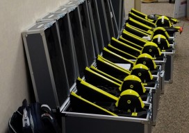
Don’t Buy a Drone
Instead, invest in a fleet of drones. (Apologies for the clickbait headline!) While I was talking to a surveyor whose firm employs UAS in their work, he mentioned the different models of the craft they have. I interrupted him: “Just how many drones do you have?” “16” was the answer. This got me thinking about...
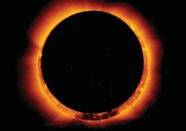
Night in the Afternoon: A US Solar Eclipse
What you need to know about the 2017 solar eclipse The upcoming solar eclipse will leave a 70-mile-wide trail of darkness across the United States on August 21, 2017 (see the map of the eclipse path on pages 44-45). This will be a once-in-a-lifetime event for many people. While another total solar eclipse will make...