Category Archives: Cartography

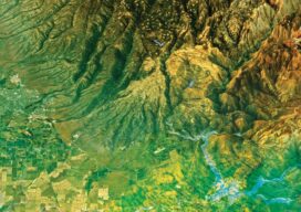
How Green Is Your City?
As tree-planting efforts take root in cities around the world, urban managers turn to geospatial tools to map and monitor their community’s canopy cover. New Yorkers are fast walkers. But there are those who prefer to take it slow, like the group of well-trained volunteers who purposely roamed around the streets of the Big Apple,...
Teaching the Ethics of Geo
Maps have always been powerful means of communication, whether etched in cave walls, stone, wood, silver of centuries past, or, in the 20th Century, copper plates and, later, film. In our own century, maps are everywhere—on our phones, computers, fitness apps, and news media, communicating in a myriad of ways about changes over space and...
xyHt Magazine Heights 2023
Click on the cover to view the Heights 2023 supplement to xyHt magazine. Articles in the issue include: From Nadir to Oblique: From traditional airplanes to new-fangled gyroplanes, we take a look at several aspects of the aerial geospatial technologies that just keep getting better. The Future of Photogrammetry: While UAVs continue to emerge as aerial mapping vehicles, there...

Your State of Happiness
Mapping Your World Kate Berg is GIS lead at the State of Michigan’s Department of Environment, Great Lakes, and Energy (EGLE) and an honoree in xyHt’s 22 Young Geospatial Professionals to Watch in 2022. She has a BS in GIS from UCLA and an MS in natural resources and environment from the University of Michigan....

Sara Thompson
23 Young Geospatial Professionals to Watch in 2023 – 21 of 23 Name: Sara ThompsonCompany: Arizona Department of Transportation Current position: Geospatial Analysis Section ManagerAge: 25 Education: BS in Conservation Biology and Ecology, Arizona State University; Certificate, GIS and Cartography, Arizona State University Thompson is a geospatial leader making a difference for young professionals across multiple...
Adamu Bala
23 Young Geospatial Professionals to Watch in 2023 – 5 of 23 Name: Adamu BalaCompany: Department of Geomatics, Ahmadu Bello University, Zaria, Kaduna State, Nigeria.Current Position: Lecturer IIAge: 36 Education: Ph.D. Surveying and Mapping Science and Technology, China University of Geosciences, Wuhan; MSc. Geomatics (2018) and B.Eng. Geomatics Engineering (2010) from Ahmadu Bello University, Nigeria;...