Category Archives: Construction/BIM
The Digital Site
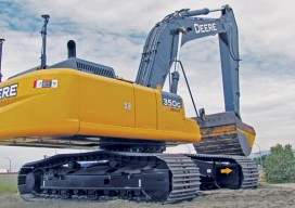
The complete digital site is more than just machine-controlled heavy equipment. Recent advances in heavy civil have been profound in connectivity, automation, and visualization. How long has automation played a role in heavy civil construction? As far back as the late 1980s when early GPS-guided (or informed) systems began to reach the market. But it...

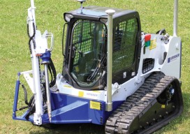
Autodesk + Leica Geosystems
Two tech giants embark on a collaboration and education outreach. At June 2015’s HxGN LIVE (the annual user conference for Leica Geosystems and other divisions of Hexagon), we spied something rather surprising: an Autodesk booth. What’s more, someone at the booth was using Autodesk software for construction layout on a consumer tablet, driving a Leica...
Robots
Above: GPS-controlled robots can measure a site fully automatically and precisely anchor screws for the foundation of a solar plant. Measuring and Anchoring As a child I used to watch a program on BBC television called Tomorrow’s World. Once in 1981, I sat in awe as it showed a snooker-playing robot. My dreams were filled with...
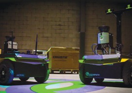
Robot Revolution
Clearpath Robotics CEO Matt Rendall discusses unmanned systems, land survey, and robotic industry trends. The robot revolution is hitting a big milestone. Robotic use is expanding beyond research activities, aerial applications, and industrial manipulators through a new kind of deployment: the service robot. These robots are autonomous, they’re geospatially aware, and they can manipulate...
25 Tips for BIM
Expert Recommendations for Better As-built BIMs Creating as-built building information models (BIMs) has been greatly facilitated by the introduction of 3D laser scanners and modeling software, but the process still has its challenges. Four experts were asked to put their decades of combined scanning and modeling experience into this list of the best tips, tactics,...
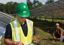
Maximizing the Sun
Solar energy grows in part due to aerial imaging and surveying. Solar power is booming in the United States. “Every three weeks,” President Obama said in his 2015 State of the Union address, “we bring online as much solar power as we did in all of 2008.” Geospatial technologies—especially remote sensing and surveying—play an important...