Geotechnical engineers say drones offer a safer, faster method of data collection to identify potential geohazards and assist with mitigation along vulnerable transportation corridors.
Mountain roadways are prime locations for geohazards, such as rockfalls, landslides, and debris flows. These events result in road closures, injuries, and property damage, sometimes triggered by thaw/freeze cycles or heavy rainfall, especially in wildfire areas where the absence of vegetation allows uncontrolled run-off.
Transportation agencies are tasked with analyzing the natural landscape and topography prior to road construction to identify and mitigate geohazards. After construction, it is an ongoing challenge to monitor land and rock deformation and schedule proactive mitigation activities, as well as respond to emergencies.
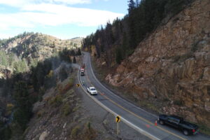
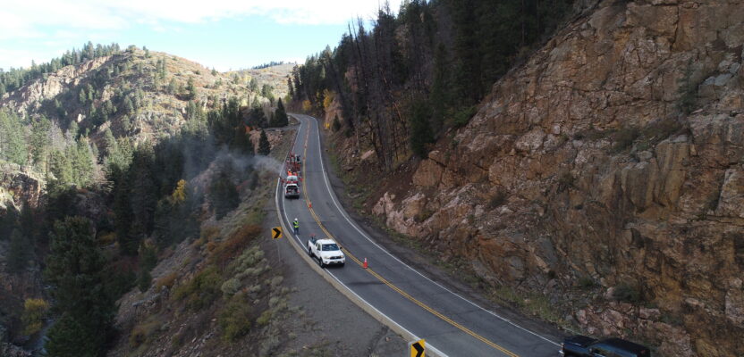
Mapping transportation projects with a drone is faster than traditional methods, which reduces lane closures and risk to personnel. Courtesy J. Altschuld.
Mapping these areas with drones offers several advantages over traditional methods, such as ultra-high-resolution datasets that are useful for multiple disciplines, minimal traffic interruptions, and faster mobilization and data collection.
Mapping Unpredictable Geohazards
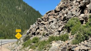
Many mountain roads in Colorado pose rockfall and rockslide hazards, so transportation projects require geohazard assessment before, during, and after construction. The Colorado Department of Transportation (CDOT) Geohazard Program utilizes a modified Colorado Rockfall Hazard Rating System (CRHRS) to help predict where problems will occur and prioritize mitigation efforts.
There are currently 750 sites labeled as chronic rockfall hazards statewide. CDOT has incorporated aerial imagery into its work since the 1990s and more recently has added drones to its data collection options.
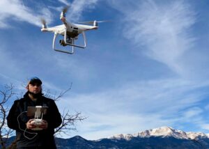
Jon Altschuld flies a small DJI Phantom 4 drone when take-off space is limited and a DJI M300 for larger projects. Courtesy J. Altschuld.
Jon Altschuld, RLA and principal at Chinook Landscape Architecture based in Centennial, Colorado, has extensive experience in environmental restoration and reclamation. By continuously experimenting with emerging technology, Altschuld adopts safer and faster techniques that deliver the best information possible for a wide range of projects.
For new roadway design, he captures drone data for pre-construction geohazard impact assessments and contributes to volume calculations for rock removal and modeling geohazard mitigation, such as rockfall netting. When responding after-the-fact, the drone captures current conditions, and the data provides guidance for further mitigation.
“I specialize in landscape architecture, trail and river restoration, and transportation projects that require a thorough understanding of topography, drainage, and geohazards,” says Altschuld. “Advances in drone technology, 3D visualization, and animation have changed how we document and communicate potential hazards, such as rockfalls, rockslides, floods, and other adverse events. The drone can get to hard-to-reach areas without putting humans at risk.”
Efficient Acquisition of Comprehensive Data
As drone capabilities have advanced, collecting aerial data for critical transportation projects has become an important service area for Chinook. The dense point clouds extracted from very high-resolution digital drone imagery provide 1:1 scale models that are detailed and accurate enough for geotechnical engineers to assess rockface stability and identify geohazards.
In 2022, Highway 119 in Boulder County experienced a rockfall overnight that completely shut down the road. Although the area was cleared of debris quickly, Altschuld provided data for a geohazard assessment to support additional mitigation work by Yeh and Associates, geotechnical engineers based in Denver.
 Traditional data collection for a transportation project usually involves ground-based lidar scanners set up along the highway to scan the rock wall. To see above overhangs, workers may rappel from the top to gather more detail about notable features with rangefinders, GNSS receivers, and a Brunton compass to measure angles of the rock. For the safety of workers and the traveling public along busy roads adjacent to rock walls, this type of data collection requires closing lanes of traffic and deploying additional personnel and equipment.
Imagery collected with a drone is more complete and higher resolution than ground-based lidar and fewer people are at risk while data is being collected. Lanes of traffic may be closed for only a short time or not at all.
Rush Job to Mitigate Hazard
Altschuld conducted the drone data collection in less than an hour of flying, followed by photogrammetric processing in the office with Pix4D software and delivering point clouds and 3D mesh for geotechnical engineers to complete an assessment.
Due to the limited take-off space in the narrow canyon, a DJI Phantom 4 drone was used to collect 0.3-inch GSD imagery with approximately 0.3 to 0.5-inch-relative accuracy on the rockfaces. For this rush project to assess local rockface stability, ground control was not used. For other geohazard projects with an absolute accuracy requirement, Altschuld would use post-processed kinematic (PPK) correction data and ground control points collected by a surveyor.
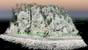
Along Highway 119 in Boulder County, the point cloud dataset with the location of images collected with the drone are marked in green. Courtesy J. Altschuld.
“With a complete 3D model of the rockface collected by the drone, we have a multi-purpose dataset,” explains Altschuld. “More people can use the data to create different deliverables, such as a visualization or animation to use for stakeholder outreach. In less time, we collect more data at a higher resolution. Yeh and I have estimated drone data collection is a quarter to a third less expensive (both in terms of time and money) than the traditional methods.”
A variety of mitigation techniques are used to protect transportation corridors, including rock bolts, steel mesh drapes, and scaling. In this case, the geotechnical engineers at Yeh and Associates used the dataset to help assess the stability of the rock slope. The next steps will be to develop a remediation plan and determine potential bolt locations and lengths. The dataset is a key factor in ensuring the bolts extend past the anticipated failure zones/joints into competent rock.
Evolving Geohazard Analysis
Altschuld is looking forward to continued developments in hardware and software that advance his work.
“Today with Pix4D, I am able to upload 2D and 3D files to the cloud so anyone can view in Chrome or whatever browser they use, and the data is accessible for more applications,” said Altschuld. “I’m expecting even more functionality in the software, as well as more automation in drone flying.
“Right now, rock walls are mostly manual flying because preplanned flights do not provide the necessary flexibility. In the future, AI may allow the drone to adjust in real time to changing conditions, and an onboard lidar sensor will keep the distance from the rock consistent. These developments will make data collection even faster.”
The high-resolution and level of detail provided in point clouds extracted from drone data provides new opportunities for analysis and improves the process of identifying geohazards to reduce risk on transportation corridors. As statewide geohazard programs continue to develop, additional deformation monitoring to support change detection will also help prioritize mitigation activities.