Category Archives: Spatial IT/GIS
HxIP as CaaS
How a prominent manufacturer of mapping airborne sensors and solutions has partnered with customers to expand its global online content service. At HxGN LIVE 2015, the annual exhibition and conference for Hexagon (parent company of Leica Geosystems), CEO and president Ola Rollén spoke about a new area of focus for the company: content services, or...

Melanie Abuel
GIS Manager, Manila Water Company, Inc. Philippines As the (very young) head of GIS development at Manila Water, Melanie Abuel leads a team that serves 6M people while managing the assets of 6000 km of pipes and 250 facilities. In addition to database and GIS mobile application development, her team works on UAV and lidar...

Managing Canada’s Data
From mapping utility poles to mapping radio frequency signal leaks, this company collects and manages much of the country’s utilities and oil and gas data. Effigis is an interesting Canadian firm that offers a range of GIS solutions for utilities and the oil and gas industry—as well as its own GNSS positioning solution for asset inventory/mapping and utility/energy...
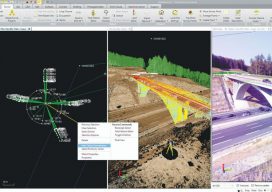
Geospatial Data United
Industry trends are moving toward consolidated environments for data visualization, processing, and management. From the title you might get the impression this article is about a soccer team. To geospatial professionals, however, the title phrase could describe an ideal situation—the ability to handle all geospatial data in a common software environment. A soccer team is made up...
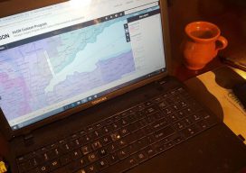
Virtualization: the Greatest Tool You Don’t (Currently) Use
This post is dedicated to a good friend, Chris Johnson, who, when we worked together a few years back, introduced me to this cool new word: VIRTUALIZATION. You see, Chris is an IT guru (see: enterprise systems architect)—a friend that every GIS guru should have so that you’ve got someone to pick up the pieces...
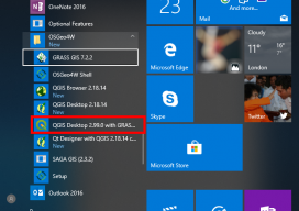
How to Use the New QGIS 3D
When QGIS revealed that they were going to add a 3D viewer, I was skeptical. Rumors were going around about it being a bolt on functionality and not really being fully adopted. To be perfectly honest, I was put off before there was anything to look at. As screenshots started to appear from Lutra Consulting,...