Tag Archives: geodesy

Canada’s New Vertical Datum: CGVD2013
Geodesy Editor’s Note: The study of Earth’s gravity field is one of the most important aspects of physical geodesy. While seldom mentioned in land surveying text books or discussed at local surveying, mapping, or GIS conferences, it is nonetheless one of the most important issues that geospatial experts deal with on a daily basis. Changing...
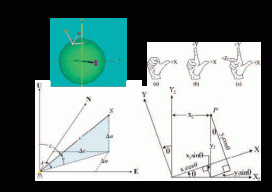
Transformation of Observations
Educate: Where Theory Meets Practice In previous articles I’ve discussed the reduction of conventional surveying observations to their geodetic equivalents. This article presents how these observations can be reduced to simple vector components that match GNSS surveyed baseline vectors. Unfortunately this transformation of conventional observations to GNSS baseline vectors involves three-dimensional rotations, so the mathematics will increase....
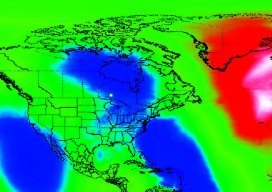
Future of Determining Elevation
A frank discussion of the different heights used in surveying, what’s inside a geoid model, and how geoid model data is used within GNSS software to produce elevations. Certainly most geospatial professionals who have used Global Navigation Satellite Systems (GNSS) within their surveying workflows have come across the term “geoid model” before. But who actually knows...
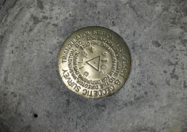
Bilby Tower Dedication Honoring Jasper Sherman Bilby
June 14, 2014 was a perfect sunny Saturday in Osgood, Indiana, where many people gathered to dedicate the last known complete survey tower and honor Jasper Bilby, the USC&GS reconnaissance man who had designed it. They included surveyors from more than a dozen states, current and retired employees of the United States Coast and Geodetic...